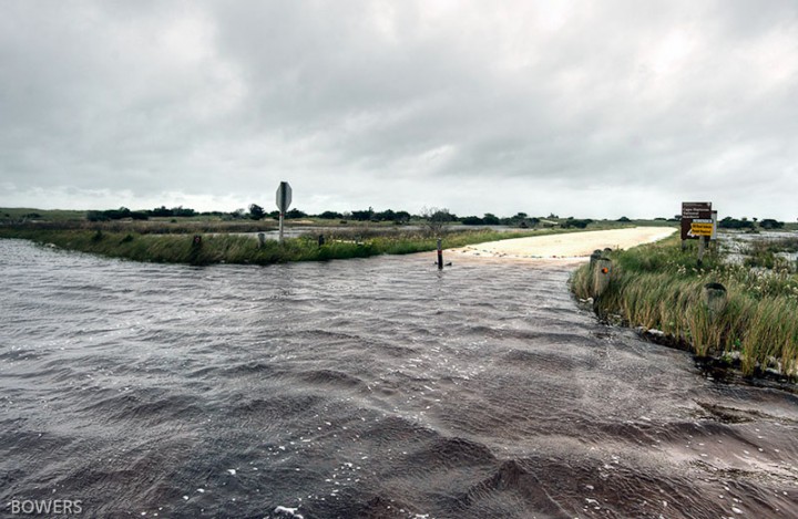
BUXTON — Epic rainfall since September has left the area around Cape Point, one of the most beautiful fishing and camping spots in the Cape Hatteras National Seashore, inundated with water and inaccessible to all but determined pedestrians.
“It’s totally unacceptable that a national campground has sat under water for six months,” said Bob Eakes, owner of nearby Red Drum Tackle Shop. “They took what was a natural habitat of cedars and live oak and turned it into a bog.”
Supporter Spotlight
But storm-flooded roads and access ramps – whether from rain, tide or overwash – have been blights at the popular off-road vehicle recreational area since 2004, when a gated ditch was sandbagged and stormwater management ceased.
Finally, the National Park Service Outer Banks Group has proposed a plan to solve the persistent drainage problem at Cape Point, a dynamic corner of beach and wetlands bordered by the Atlantic Ocean and Buxton Woods maritime forest.
In its plan, a 3- to 4-foot trench would be dug to allow water to drain into the ocean, and an upstream culvert would be converted to a weir.
The Feb. 26 document, officially a request for a federal consistency determination, must be reviewed by the state Department of Environmental Quality’s Division of Water Resources, which will make a determination whether to authorize it within 60 days.
Eakes said that the drainage system had functioned well for the environment for years, but that the past decade of inaction by the Park Service has resulted in loss of habitat for protected species, including the endangered piping plover. The paradox was not lost on the local community, which now has restrictions on beach driving based in part on the effects of beach driving on nesting plovers.
Supporter Spotlight
“They’re not managing it for birds,” he said of Cape Point. “They’re not managing it for people. They managing it now for mosquitoes.”
But Dave Hallac, the current park superintendent, decided soon after he arrived in January 2015 to try to resolve the drainage problem. In the process, he traced it back to a state violation notice that was issued in 2004, after a staff member with the N.C. Coastal Federation reported her concern about a dark stream of water going toward the ocean that she had observed while flying over Cape Point’s wetlands.
A subsequent memo to the park provided historical context on the drainage.

“In the past, when the area flooded, the headgate west of the campground would be opened and water would drain through a 36-inch culvert under the dunes,” Larry Martin, a U.S. Dept. of Interior hydrologist, wrote in a 2005 memo to the superintendent of the seashore.
Drainage was helped along by ditch that was dug from the outfall of the culvert to the ocean. When water in the campground and on the roads had receded, the headgate would be closed.
“The hydrology of the Cape Point area has been highly manipulated by construction of drainage ditches, excavation of sand for beach nourishment, resulting in formation of ponds, and construction of artificial dunes,” Martin wrote.
The park opened additional ditches after Hurricane Isabel in 2003, according to Martin.
After the complaint from the federation, the two drainage ditches on the east-facing beach were closed – although another ditch west of the campground continued draining into the ocean. In April 2004, officials from the state Division of Water Quality and the Army Corps of Engineers visited the drainage areas and subsequently issued a violation notice for draining wetlands. Park staff then closed the headgate and used sandbags to limit the flow of water from the ditches through the dunes into the ocean.
“Since the closure of the drainage ditch, interdunal roads south of the campground have been flooded almost constantly,” the memo said.
The only remedies, Martin wrote, would be elevating the roads or opening a ditch to the ocean.
Robert Tankard, assistant supervisor in the regional office of the state Division of Water Resources, said that it seems that the Park Service staff only read the first few paragraphs of the notice of violation, which suggested that one alternative was closing the culvert. But other options were named further down in the document.
“They could have done this easily by just providing us a plan and providing us the water level they were going to maintain,” he said. “But they took it upon themselves to plug it.”
Tankard, who had signed the 2004 violation notice, said the violation expired long ago.
If the review of the proposed drainage plan is favorable, he said, a water quality certification would be issued as part of the CAMA major permit. A permit is also required from the Corps of Engineers, Tankard said. The division will continue to monitor the wetland water levels with gauges.
Before the Park Service had issued its proposed drainage plan, Hallac said that it was considering installing a pumping system. But the idea was scrapped because the noise would disturb wildlife.
After every tropical storm or major rain, access ramps 43 and 44 and the campground inevitably would flood. But it has never been as bad as it has since late September, Hallac said.
After a series of storms, including Hurricane Joaquin, he said, water was knee high around access roads and beach driving ramps to Cape Point – likely the most popular ramps in the seashore. By necessity, the roads were closed, and were not reopened until standing water was a foot or less. Additional rainstorms exacerbated the situation.
Flooding forced Ramp 44 to be closed to off-road traffic to Cape Point from October to before Christmas. As recently as last month, rainwater covered marshes and ramps.
“The most common complaint I heard was ‘You made us drive through the saltwater, ’Hallac said.
Testing of the floodwater, however, revealed no more salt, he said, than the amount in bottled water.
Hallac said that according to data from the National Oceanic and Atmospheric Administration, rainfall at Cape Hatteras from September through February usually averages about 22 inches. But in the last six months, 36.61 inches had fallen, making that period the wettest six months since 1934.
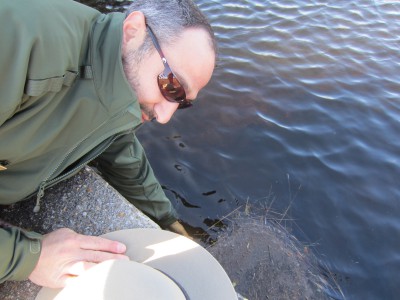
During an off-road vehicle tour last month of Cape Point, Hallac pointed out locations of canals and culverts that had been part of the former system.
“There’s no natural drainage,” Hallac said, hopping out of his truck just past Ramp 45 at South Beach, a bald stretch of sand at least 500 feet to the ocean that is closed to off-road vehicles. “We were digging a pretty big ditch to get it out here.”
Resuming the tour, Hallac pointed toward the man-made Salt Pond where water used to collect, now flat and filled with sand. Scrubby vegetation soon became thicker, and Hallac stopped at the place where the culvert had been closed and sand-bagged in 2004.
The gate is opened, he said, but no one knows whether water is able to flow through it.
A drainage canal is behind Cape Point Campground, where virtually every one of the 200 campsites was waterlogged. Picnic tables stood in grass covered in inches of rain.
“You see, “Hallac said, “you look left, you look right. The whole area is flooded.”

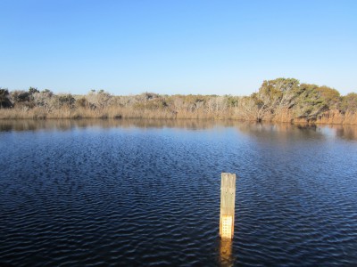
A staff gauge – a ruler on a two-by-four – had measured as high as 100 centimeters – about 39 inches. Last month, it measured 80 centimeters, or about 31.5 inches. In order to maintain the integrity of the wetlands, water should be managed to about 20 to 30 centimeters or about 8-12 inches.
Mark Ford, a Park Service wetland ecologist in New Orleans, said that re-establishing the ditch seemed reasonable, especially in light of climate change and rising seas. “Drainage into the ocean is not an unnatural thing,” he said. “This is pretty extreme rain. I’m surprised there’s still flooded areas.”
When money is available, he said, the Park Service would like to install water wells – a small pipe in the ground – to collect data on sea level rise at Cape Point.
Ford said he does not expect the proposed project to be a detriment to the wetland.
But fixing the hydrological balance at Cape Hatteras is another challenge, he said.
Buxton Woods’ wetlands have degraded over time and are showing signs of stress. And pavement at the campground hinders natural drainage, although he said no one is talking about removing it.
“It wants to be a wetland,” Ford said.
Chris Egghart, an environmental specialist who has visited Cape Point for 45 of his 55 years, said that the irony of the Park Service’s newly proposed plan is that it essentially is reconnecting the old self-regulating system that had allowed the stormwater to drain through the dune line to the ocean, without depleting the healthy water level in the wetland.
“This is what should have been done 10 years ago,” he said. “It’s so simple.”


