WILMINGTON – A planned terminal groin on one of North Carolina’s few remaining natural inlets could wipe out a premier nesting area for least terns, a type of small shorebird already endangered by human activity.
The threat comes as least tern populations are showing some signs of recovery here after being nearly wiped out by hunting decades ago and more recently by coastal development.
Supporter Spotlight
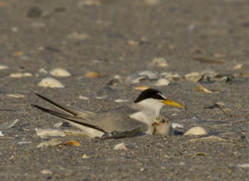
“The north end of Figure Eight Island is just once again gangbusters,” said Lindsay Addison, an Audubon North Carolina coastal biologist.
The spit of unspoiled beach stretching from the developed north end of the private island to Rich Inlet is critical habitat to thousands of shorebirds, including threatened piping plovers.
It’s also where the Figure Eight Island Homeowner’s Association Board of Directors wants to build a terminal groin to protect homes from beach erosion, a move environmentalists fear would eventually wipe away much of the roughly 60-acre spit.
A supplemental Environmental Impact Statement, or EIS, for the proposed project is expected to be released in the coming weeks by the Army Corps of Engineers.
“We’re reviewing it right now and we’re on the final end,” said Mickey Sugg, project manager in the corps’ Wilmington district office. “We’re pushing for certainly within a month.”
Supporter Spotlight
Projections by engineers hired by the island’s homeowners association to design a terminal groin project show that the spit of beach crucial to shorebirds will eventually erode away if a groin is built.
The modeling “assumed a worst-case scenario for inlet dynamics,” according to the association’s board of directors, which argues that a groin may instead help protect nesting habitat.
Figure Eight Island Administrator David Kellam did not respond to a request for comment.
Mike Giles, a coastal advocate with the N.C. Coastal Federation, said that altering the inlet will destroy the natural process vital to shorebirds.
“Rich Inlet represents how Mother Nature can actually take care of our coast,” Giles said. “The spit has grown and has provided an unbelievable piece of habitat for wildlife and for people. This is a public treasure that should be protected and not destroyed by a small, private group of homeowners.”
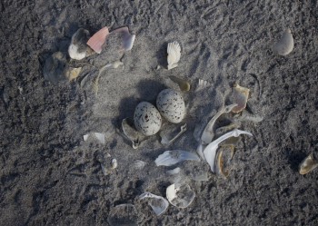
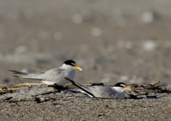
Last year, 840 pairs of least terns – the largest colony in North Carolina in more than 40 years – nested on Figure Eight’s north end.
“Pretty much all the least terns in the Cape Fear region were at that site,” Addison said.
The numbers, which were not immediately available, aren’t expected to be quite as big there this year primarily because least tern nests are more evenly distributed in other areas, including Lea-Hutaff Island, Fort Fisher and the northern and southern ends of Wrightsville Beach.
This year, 232 nesting pairs of least terns have been documented on the southern end of Wrightsville Beach. That’s well below the 597 nesting pairs documented in 2012, but significantly higher than 2014.
“Last year we had five pairs that tried to nest and failed and they failed primarily due to disturbance from the dredging re-nourishment project,” Addison said. “We’re very happy that they’re back. It’s just so important that they have multiple places that they can use.”
Rich Inlet sways between the north end of Figure Eight and Lea-Hutaff Island, one of the state’s few remaining un-bridged, undeveloped barrier islands.
The U.S. Fish & Wildlife Service designates the land created by the inlet’s movement as “critical nesting habitat” for threatened piping plovers.
There is at least one confirmed piping plover nest on the northern end of Figure Eight Island, said Sara Schweitzer, coastal water bird biologist with the N.C. Wildlife Resources Commission.
“These southern beaches we’ve just had one nest pop up here and there the past several years,” she said. “The southern beaches are much more developed than those further north, including our national seashores. The piping plover seems to be super sensitive to that disturbance.”
Rich Inlet is a “very important” area for nesting and migration, Schweitzer said.
“I’m pretty sure from the resource side of the story we would be pretty concerned with the impacts of a hardened structure on that site,” she said. “Something that’s as permanent as a groin is going to undergo a lot of scrutiny.”
The wildlife commission along with other federal and state agencies that protect natural resources has yet to have that opportunity.
“That’s a concern,” said Giles.
The corps should have initiated formal consultation with the agencies that oversee the protection of endangered and threatened wildlife long before now, Giles said. The corps released the draft EIS in May 2012.
A final EIS should not be issued without completing the required consultation under Section 7 of the federal Endangered Species Act, according to a federal rule issued by the Council on Environmental Quality, which establishes uniform standards for federal environmental impact statements.
The rule states that “to the fullest extent possible, agencies shall prepare draft environmental impact statements concurrently with and integrated with environmental impact analyses and related surveys and studies required by the Fish and Wildlife Coordination Act, the National Historic Preservation Act of 1966, the Endangered Species Act of 1973 and other environmental review laws and executive orders.”
Sugg said federal consultation “will likely happen” after the supplemental EIS is released.
The corps initiated a supplemental EIS late last year after the HOA board submitted a design not included in the draft EIS. This preferred option is a rock groin 80 feet wide and would extend 1,200 feet across the beach and into the ocean.


