Last of two parts
RODANTHE –Take the driving tour of N.C. 12 that we featured yesterday on a Wednesday this summer and stop at the Pea Island National Wildlife Refuge for a guided walk on the beach. You’ll be rewarded with a close-up look at one of the most dynamic and changing landscapes in the world.
Supporter Spotlight
The N.C. Coastal Federation, along with the U.S. Fish and Wildlife Service, is offering family-friendly weekly beach walks at the refuge each Wednesday this summer from 9 a.m. to 10 a.m.
Enjoy the secluded beach while learning about barrier island migration and local plants and animals with Ladd Bayliss, a coastal advocate with the federation. A scavenger hunt appeals to kids of all ages, and guide books are provided to help them identify shells they find or marine creatures they spot.
The free walks begin at the oceanside parking lot, just south of the new inlet that a storm created a few years ago in this shifting landscape.
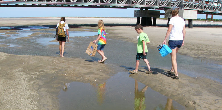 Federation Coastal Advocate Ladd Bayliss, left, takes the Boyer family on a guided beach walk at Pea Island. |
On the inaugural walk recently, Bayliss showed maps of the area to the Boyers, a family from Georgia. She explained how local waters such as the Alligator River and Albemarle and Pamlico sounds drain to the ocean through nearby Oregon Inlet and how barrier island geology makes the islands susceptible to erosion and break-throughs by the ocean.
More than 80 percent of the coast’s barrier islands, Bayliss notes, have been breached by the ocean at some point in their histories.
Supporter Spotlight
That’s what Hurricane Irene did in August 2011 when it broke through at the S-curves north of Rodanthe and also opened New Inlet at Pea Island, thus taking out the only road access to Hatteras Island in two places.
A temporary bridge over New Inlet has been the solution since then for the troubled section of roadway, with plans for a permanent bridge to be finalized in the coming months.
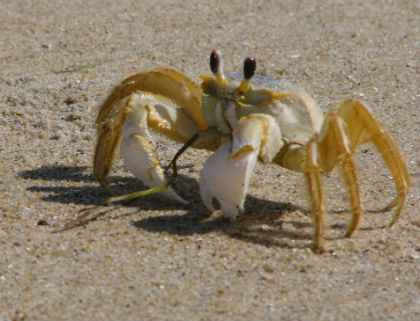 This ghost crab was one of the many critters seen on the beach walk. |
New Inlet long ago was a breach close to the current one that closed up, briefly reopened in the 1930s and closed up again. Hurricane Irene’s “new” New Inlet was close enough to end up being referenced by most locals as simply as New Inlet.
N.C. 12 at the S-curves was overwashed time and time again by storms over the past fall and winter, including Hurricane Sandy in October and several nor’easters, and the best solutions for that area of Hatteras Island are still being studied, discussed and debated at the state level.
Bayliss produced an aerial map from the early 1990s that showed N.C. 12 running east of the old ranger station, just beyond the sand dunes. Now the road runs west of the old station, she explained, producing another aerial map.
“Barrier islands migrate west and south,” she said.
When the federal government’s Works Progress Administration built the sand dunes from the Virginia state line to Ocracoke in the 1930s, instead of protecting the islands, the dunes stopped the natural overwash that created the islands’ movement, she said. This ended up making the islands smaller, because the sand was swept away instead of re-nourishing the other side of the island.
A large ghost crab scuttled by, commanding the group’s attention.
Bayliss explained how ghost crabs live in holes on the beach but must go to the ocean at least once a day to wet their gills. She added that they can run up to five feet per second.
Sarah Boyer, the elder of the two children, happened across a cormorant’s body that was partially buried in the sand.
Bayliss noted that the bird swims underwater and “its hooked bill actually stuns fish.”
As the wind whipped across the ocean and then the beach, Bayliss explained how Pea Island got its name.
“Beach pea was everywhere,” she said. “Over the winter, snow geese populations would eat it. It had so much energy.”
Walking under the New Inlet bridge, the high-tide line was visible and several tidal pools remained. Still, the bridge for the most part spans dry sand—at least currently.
Barrier islands are characteristically dynamic.
“The water was waist-deep last summer under the New Inlet temporary bridge,” Bayliss noted.
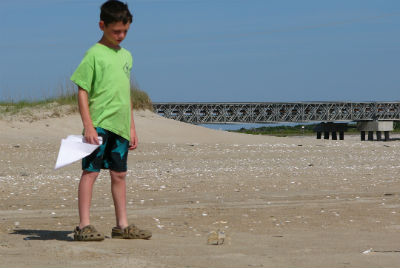 Pea Island visitor Daniel Boyer has a staring contest with a ghost crab. |
A storm or strong high tide could once again push a great deal of water under the bridge.
Bayliss hopes beach walk participants will learn “how this is a living, breathing system and everything we do to alter it, even doing things we have to do, like roads…is something that has to be compensated for elsewhere.”
Humans’ actions cause sometimes unforeseen reactions by nature, as demonstrated by the installation of sand dunes.
Immediately west of the temporary bridge is a roped-off, protected area where least terns, a type of shorebird, nest.
The smallest of the terns, least terns resemble diminutive gulls and nest on the ground, in large colonies for safety. They put their chests on the ground, and then dig sand with their feet to make their nests, often in areas strewn with shells, Bayliss said.
She provided binoculars, and Sarah and Daniel Boyer looked at least terns darting through the air.
Bayliss held up a small shell, noting its name: Coquina.
“Coquina Beach is right up that way,” she gestured to the north.
The kids borrowed two guide books from her to identify shells they had collected, which included one Sarah found called a false coquina.
Their father, Ken Boyer, said appreciatively of the beach walk, “I learned some stuff I wouldn’t have picked up otherwise.”
Participants are encouraged to bring water and sunscreen and to wear shoes appropriate for walking on soft, hot sand.

