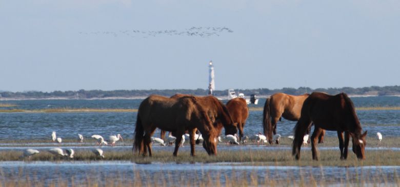
The beacon of the Cape Lookout Lighthouse sweeps across Back Sound and the wild horses on Carrot Island. Photo: Sam Bland.
 |
BEAUFORT — Under a warm sun on a gorgeous fall afternoon, I slid my kayak into the flat waters of Taylors Creek along the business waterfront of this Carteret County town.
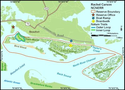
A stone’s throw across the creek is what appears to be one island that runs parallel with the waterfront for over two miles. What I have always thought of as Carrot Island is actually four islands, including Bird Shoal, Town Marsh and Horse Island. This group of islands, along with a section of salt marsh called Middle Marsh, is a nature lover’s destination known as the Rachel Carson Reserve.
Supporter Spotlight
Preservation of these islands started in 1977 when local residents objected to proposed development of the islands. By 1989, all four islands consisting of 2,315 acres of salt marsh, dunes, beaches, tidal flats, shrub thickets and maritime forest, were protected. This is one of 10 state education, research and recreation sites managed by the N.C. Coastal Reserve and National Estuarine Research Reserve. The site is named after the great ecologist and writer Rachel Carson who alerted us in 1962 to the effects of pesticides in the environment in her book Silent Spring. Also, her 1955 book The Edge of the Sea, was inspired by her time spent in the marshes in and around the Beaufort area.
I decided to paddle around these same waters and let my senses enjoy the pleasures of the day.
Heading east along Taylors Creek, the tide is in my favor and at times I only use my paddle as a rudder. I swiftly and silently glide past numerous “snowbird” sailboats that have taken rest among the mooring buoys that line the creek in their southward quest to outrun winter. I turn my boat south into a tidal creek known as Deep Cut, which separates Town Marsh to the west and Carrot Island to the east. Waist-high marsh grass delineates the creek and clumps of oysters stick up like knife blades through the water.
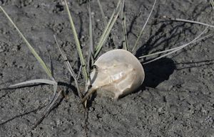 The molt of the horseshoe crab on Bird Shoals. Photo: Sam Bland. |
I continue on until Deep Cut isn’t deep anymore and ditch my kayak on the highest nearby sandbar. Walking out across a mud flat, an army of fiddler crabs greets me and parts like the Red Sea, creating a path that quickly closes behind me. From here, I can see Horse Island to the east, which lies parallel to and is south of Carrot Island and Bird Shoal to the west, which runs parallel to and is south of Town Marsh.
Off in the distance I can see the silhouettes of about 25 horses with heads bowed and as still as statues. The origin of these horses is still debated. The reasonable theory is that they were put on the island for grazing in the 1940’s by a Beaufort resident and over the years they became feral, or wild. The romantic theory is that they swam over from Shackleford Banks where the horses are known to be decedents of Spanish mustangs that survived shipwrecks long ago.
Supporter Spotlight
Either story is fine with me, the horses are magnificent. Their long, wind tangled manes cascading down and their shiny coats creat handsome sturdy creatures.
I observed them for a couple of hours, unable to escape their allure. The dynamics of the group soon became obvious with the dominant males staring down any rival that strayed too close.
Since they are considered a cultural resource, they are not managed as an exotic species even though their presence does create some resource damage. The reserve staff conducts a number of research and habitat restoration projects designed to reduce sediments loosened by their hooves from reaching the wetlands by stabilizing the soil with native plantings. These project areas are identified by the protective fencing that prohibits horse grazing and trampling. They also employ a birth control program to keep the population under 40 horses.
Reluctantly, I left the horses munching on the marsh grass while flocks of white ibis probed the ground for fiddler crabs and I walked over to the white sandy beaches of Bird Shoal. Here and there tiny horseshoe crab molts are scattered about. Semipalmated plovers dominated the sand flats with a few ruddy turnstones and a couple of piping plovers mixed in. Closer to the water’s edge, large groups of brown pelicans were roosting and busy preening their feathers. Then, a cloud of black skimmers rose into the sky and drifted in unison towards Shackleford Banks. As if choreographed, they flashed their black backs and white bellies as they rapidly changed direction before finally settling back down exactly where they left from. The reserve is a birding hotspot with close to 200 species of birds having been documented there.
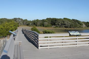 The boardwalk on Carrot Island is a good place to take in the beauty of nearby Middle Marshes. Photo: Sam Bland. |
Watching the birds from a low mud flat, where many a Beaufort resident have scratched out a few clams, I could feel tidal water leaking into my shoes and realized that I better check on my unanchored kayak. I hustled back without a moment to spare as the kayak was now floating on the rising tide.
I paddled east in the waters that separated Carrot Island and Horse Island. Years ago, much of Carrot Island and Town Marsh for that matter was fortified and elevated with dredge spoil material. This has allowed pockets of shrub thickets and maritime forests to establish a foothold over the years. The red cedar and live oak trees have been sculpted into gnarly shapes by years of salt laced southerly winds. Within these upland areas, raccoons, foxes (gray and red) and rabbits (marsh and cottontail) are able to survive in these harsh coastal conditions.
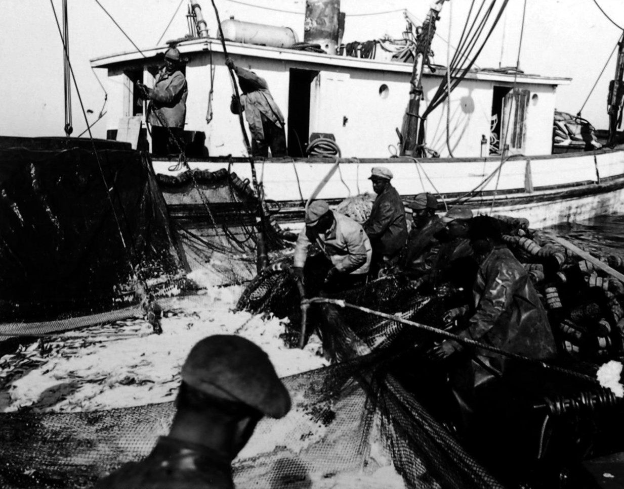
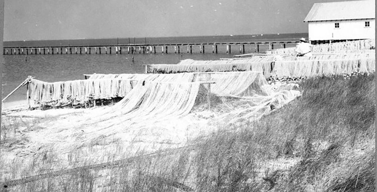
Companions joined me beside the boat. Striped mullet repeatedly jumped out of the water landing each time with a slap. In the early 1800s, Carrot Island was the site of a thriving mullet fishery. The fish were netted, cleaned, salted and then sold in Beaufort.
The unique name of the island is the result of the number of carts that were used by fishermen to move their catch of fish from the south side of the island to Beaufort. At the time, there was a “bridge” built of ballast stones piled across Taylors Creek. A number of the carts were often left, or stored, on the island during the year. Cart Island, as it was originally known, eventually became Carrot Island. If you hear the word “cart” in the Down East brogue, it sounds a bit like the word “carrot.”
Native Americans, particularly the Coree Tribe, also used the island to catch red drum, speckled trout, oysters, clams and crabs that surrounded the island.
The island was also used as a campsite by British troops during the Revolutionary War.
By now the tide had flooded in and was higher than usual allowing me to paddle everywhere I wanted. A flooded raccoon trail was just deep enough for me to paddle across a marsh island to reach the Carrot Island boardwalk. Here, I took a break and absorbed the views of Middle Marsh where great egrets and great blue herons took refuge in the shrub thickets from a high tide that was too deep for their long legs. Overhead, a couple of kingfishers loudly chattered as they argued over fishing territory rights. A sinking sun cast a golden illuminating glow on everything it touched. The light was so flattering it could have even rendered an opossum beautiful.
I paddled back towards Town Marsh along the south side of Carrot Island, reaching Deep Cut I turned for one last glance of the ponies. In the distance the beacon of Cape Lookout swept out across the marsh beckoning like beautiful siren.
A trip to the Cape will need to wait for another day since one afternoon was not near enough time on the reserve. I need a day to check out Middle Marsh, another day to spend just watching the horses, another day for birding, another to hike the Town Marsh trails, another day to…

Regardless of their origins, the wild horse of the Rachel Carson Reserve are magnificent creatures with tangled, windswept manes cascading down their handsome, sturdy bodies. Photo: Sam Bland.

