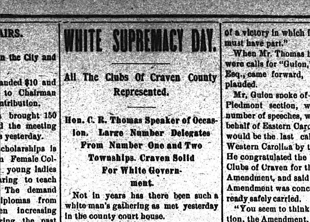
Well before, and long after, the Declaration of Independence was signed in 1776, Dare County has been the site of pivotal moments in the country’s history.
The historic county on the Outer Banks has incorporated what it calls “the unique contributions of our region to the broader story of the United States” into its official America’s 250th anniversary celebration, “Land of Beginnings.”
Supporter Spotlight

The phrase “Land of Beginnings” comes from the many nationally significant firsts that occurred there, “including the first English colony in the New World, the birth of Virginia Dare, the first Freedmen’s Colony during the Civil War, the first powered flight, and the first transatlantic wireless communication,” Dorothy Hester, co-chair of the Dare County A250 Committee, explained to Coastal Review.
Dare A250 is the county’s official planning committee for America 250 NC, the state’s commemoration effort under the North Carolina Department of Natural and Cultural Resources. The state-organized celebration is part of America 250, the national U.S. Semiquincentennial Commission that marks the anniversary of the signing of the Declaration of Independence.
“America 250 is about telling the full story of the nation’s origins, and Dare County represents several of the earliest and most consequential chapters in that story,” Hester said. “I am incredibly proud of the many organizations, volunteers, and community members who have come together to create meaningful and lasting ways for people in Dare County to connect with our local history during this celebration.”

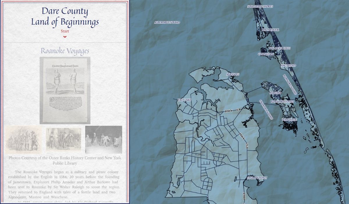
The committee rolled out two activities associated with the anniversary earlier this month. The “Land of the Beginnings” interactive map that highlights 28 historic sites and the self-guided Dare A250 Passport Program.
The county is also preparing for the April 18 patriotic festival “Dare A250 Faire: Liberty, Legacy and Liftoff in the Land of Beginnings” at the Wright Brothers National Memorial. Arts and crafts vendors must submit their application to set up by Feb. 1, all other vendors have until Feb. 15. Applications for both can be downloaded from the website.
Supporter Spotlight

“As Dare County’s signature event commemorating the nation’s 250th anniversary, the A250 Faire will feature live music, food and beverage vendors, local artisans, historical demonstrations, educational programming, community exhibits and patriotic festivities that highlight Dare County’s enduring spirit of innovation and discovery,” according to the website.
Outer Banks History Center Director and Supervising Archivist Tammy Woodward said that for the past year, she has been the history subcommittee chair for Dare County’s A250 Committee. The center is the eastern branch of the State Archives of North Carolina.
The first project that they were charged with was to draft a timeline of the history of the county dating back to the 16th century, “or as far back as the written record can take us. From that timeline, we selected 28 sites to plot on an interactive digital map with short historical narratives and images for each site.”
The subcommittee members are Kristen Stilson, a GIS analyst for the county, Jockey’s Ridge State Park Ranger Austin Paul, Brian Edwards, associate history professor and chair of the Social Sciences Department at the College of The Albemarle, Meaghan Beasley from Dare County Libraries, and Ladd Bayliss, executive director of the Outer Banks Conservationists.
Stilson creates Dare-themed maps each year for National GIS Day in November, and was asked to tie this year’s annual map in with the A250 celebrations. She used the subcommittee’s timeline of Dare County’s history to design the interactive map that allows users to learn about the nearly 30 sites around the county.
“We chose historic events that highlight the role of Dare County in the formation of our country from the first voyages to the first flight. And also events that celebrate beginnings in Dare County, like our first lighthouses and lifesaving stations,” Stilson explained.
Woodward said that history subcommittee members and volunteers wrote and sourced the narratives and images on the interactive map. The names of the map’s contributors and their associated agencies can be found at the bottom of the map if you scroll all the way down.
“We had writers from many organizations across Dare County, this was huge collaboration,” Stilson said, adding that the sources vary for the write ups and the majority of the photos came from Outer Banks History Center. The history center is the eastern branch of the State Archives of North Carolina, under the N.C. Department of Natural & Cultural Resources.
“My favorite tidbit I discovered was the man that purchased Kitty Hawk Pier because they didn’t serve orange soda and then when he sold it later, he gave the profits to the employees,” Stilson added.
Stilson said that from there, she still needed a way to connect the map that launched in January with GIS Day in November.
“That is when we came up with the passport program” that culminates Nov. 18 on National GIS Day, she said.
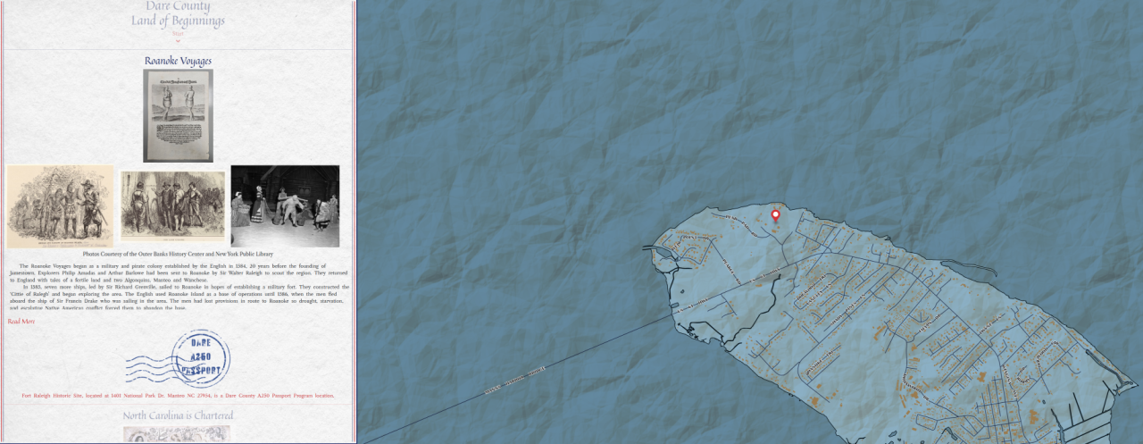
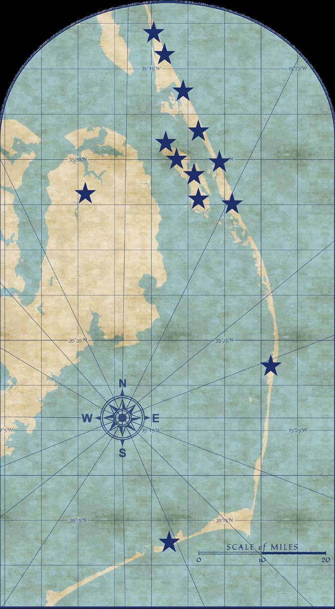
The history subcommittee selected from the interactive map the 13 sites that are stops for the passport program, described in promotional materials as “an initiative designed to engage residents and visitors in commemorating America’s 250th anniversary by exploring the many places that have changed the course of history and define Dare County as the ‘Land of Beginnings.’”
At each passport site, participants can scan a QR code to collect a virtual stamp, gradually building a digital passport that reflects the participant’s voyage.
The 13 passport sites are marked on the interactive map and a hint of where the QR code signs are located on the property. Visitors can scan the code to log their visit to the site.
“Users can explore the county and significant places from their computer or they can get out and explore the places these historical events occurred in person,” Stilson explained about the two tools.
Once the program wraps up on GIS Day, participants will earn certificates based on how many locations they visit.
The following are the 13 stops:
Flat Tops of Southern Shores are unique homes built in the 1950s that reflect the vision of Frank Stick and the early development of the community. “Their simple design and iconic flat roofs remain a symbol of Outer Banks history,” as described by the county in promotional materials.
Icarus Monument to a Century of Flight in Kitty Hawk is “an enduring sculptural legacy to the first century of aviation” according to the monument’s website.
Wright Brothers National Memorial in Kill Devil Hills celebrates when Orville and Wilbur Wright made history in 1903 with the world’s first powered flight. “The memorial celebrates their innovation and the birth of modern aviation,” as county officials described it.
Jennette’s Pier in Nags Head was originally built in 1939 and now serves as both a fishing pier and an educational center for marine science.
Jockey’s Ridge State Park in Nags Head is home to the tallest living sand dunes on the East Coast and has been protected as a state park since the 1970s.
The black-and-white-striped Bodie Island Lighthouse in Nags Head has guided mariners since 1872 and its beacon continues to aid in navigation.
Fort Raleigh National Historic Site in Manteo “preserves the site of the first English settlement in the New World, established in 1587 it’s a place tied to the mystery of the Lost Colony and the roots of America’s story.”
Island Farm, also in Manteo, is a living history site depicting what daily life was like on Roanoke Island in the 1850s. Visitors can experience farming, cooking and traditions of early Outer Banks families.
Bethany Church in Wanchese, built in 1857, is one of the oldest churches on Roanoke Island.
The historic Chicamacomico Life-Saving Station in Rodanthe tells the story of the U.S. lifesaving service, the forerunner of what is now the U.S. Coast Guard.
Graveyard of the Atlantic Museum located at the edge of Hatteras Island highlights maritime history, legends and survival.
Pea Island Cookhouse in Manteo honors the legacy of the Pea Island Lifesaving Station, the only all-Black crew in the United States.
Now a ghost town, Buffalo City at the Alligator River National Wildlife Refuge on the mainland was known for its logging and moonshine.
“Through the interactive historical map, passport program, the A250 Faire, special events, and youth-focused activities, we’ve worked to ensure there is truly something for everyone—whether you’re a lifelong resident, a student, or someone discovering Dare County’s story for the first time,” Hester said.