Want to visit a particular spot along one of North Carolina’s beaches or coastal waterfronts this summer?
There’s a map for that.
Supporter Spotlight

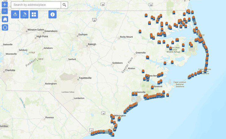
The North Carolina Division of Coastal Management’s Public Beach and Coastal Waterfront Access Program is an online, interactive map accessible from mobile devices and desktops that allows users to find sites within 1 to 10 miles of a location.
The map provides information on the location and amenities within the area, such as public restrooms and showers, for more than 800 local, state and federally funded access sites along the state’s ocean shores and estuarine waters.
Questions or comments may be directed to Rachel Love-Adrick at Rachel.love-adrick@deq.nc.gov. Include the site location in your correspondence.
The Public Beach and Coastal Waterfront Access Program began in 1981. Since that time 30 grants totaling more than $55 million have funded improvements to public waterfront access, such as walkways, dune crossovers, restrooms, parking areas, and piers. Funds may also be used for land acquisition or urban waterfront revitalization.