This post has been updated.
While the Outer Banks with its famed shipwrecks, pristine sand and historic sites, are, in many ways, the prototypical beaches of North Carolina, not all beaches were settled in the same way as those in Currituck, Dare and Carteret counties.
Supporter Spotlight
Sunset Beach, which is on the South Carolina border, is one of those. Though it’s located in a historic region of North Carolina, the Brunswick County town’s history as a tourist attraction is recent.
The town has gone from an ignored stretch of sand to a destination for retirees and weekend visitors alike in the last 70 years.
Ann Bokelman, moved to the town in 2007 from Richmond, Virginia. She said they looked at several other beaches when considering where to buy a lot, but “when we found Sunset Beach, we never looked back.”
Bokelman said Sunset Beach is a “sweet spot” almost perfectly in between Myrtle Beach and Wilmington. Its location has kept out the long stretches of apartment complexes and other indications of a bedroom community.
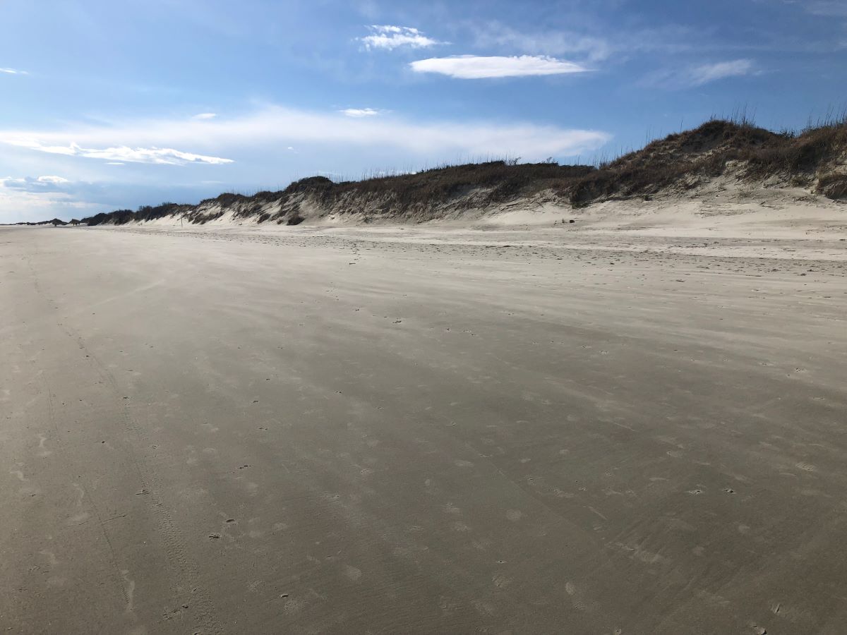
Sunset Beach is one of the Brunswick County beaches, a set of barrier islands that stretch from Bald Head Island to the east and the South Carolina border to the west.
Supporter Spotlight
West of Oak Island, these islands were mostly uninhabited before the 20th century. Unlike some of the Outer Banks, these islands were durable. Many of them appear, albeit unnamed, as early as the 1737 Moseley’s map. The island that became Sunset Beach was originally known as Bald Beach.
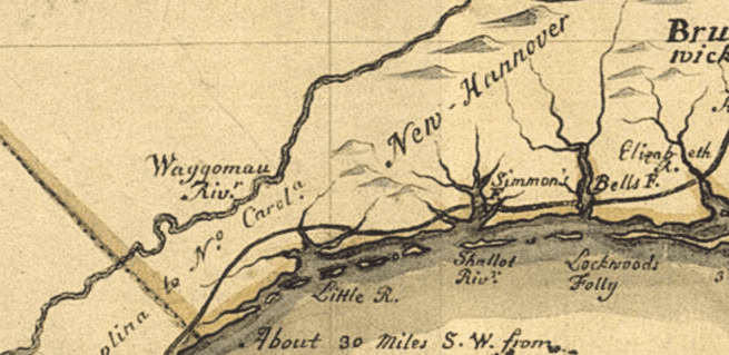
Despite their status as coastal islands with long beaches, Bald Beach and its neighbors were practically ignored by North Carolina residents. Located on the other side of large swamps, Brunswick County settlers instead focused on the major rivers and creeks of the county.
They started large cotton plantations and even grew rice in isolated areas. This focus on cash crops dominated the attention of Brunswick County settlers much more than sand-covered barrier islands.
The closest sizable town until the 1880s was Smithville, now Southport, more than 30 miles to the east, although unincorporated Shallotte, Supply and Calabash were somewhat closer.
Bald Beach was virtually ignored throughout the 19th century.
It was bypassed during the Civil War as Federal troops occupied the Sea Islands of South Carolina, and took Fort Caswell on nearby Oak Island.
One exception was in 1864, when the blockade runner Vestaran aground off Bald Beach on its way back to Wilmington. But in general, the region that is now Sunset Beach remained swampland and a plot of sand.
In his 1952 book, “Graveyard of the Atlantic: Shipwrecks of the North Carolina Coast,” historian David Stick referred to the area by the name of a nearby inlet — Tubbs Inlet — not the beach.
As late as 1958, “A New Geography of North Carolina” lumped Bald Beach together with neighboring Bird Island as the last two “undeveloped” barrier islands of North Carolina before reaching the southern border.
Settlement of the area did not begin in earnest until years after the establishment of the Intracoastal Waterway in the 1930s. This extensive passage stretches from Massachusetts to Texas and was mostly constructed by expanding and joining existent bodies of water.
The construction of the waterway brought more attention to the beach areas of the Atlantic coast and the Gulf. While the waterway provided easy water access, the state of North Carolina provided a close highway connection with the completion of U.S. Highway 17 in the 1920s.
More car and boat traffic made travel to Brunswick County beaches feasible. One by one, the state and local developers pushed highways through Brunswick County to bridges that would make the islands habitable.

The private developer who made Sunset Beach possible was Mannon C. Gore. Gore, a local farmer and World War II veteran, purchased the island in 1955 for $55,000 and built a drawbridge in 1958 connecting the island and mainland.
He then built a pier, began to sell off lots, and renamed the area Sunset Beach in 1958. In 1963, the town was incorporated with a section on both the mainland and the barrier island.
Ever since its establishment, Sunset Beach has exploded in popularity as a travel destination. It has benefitted from the growth of the Myrtle Beach area to its south and the continued migration of retirees to the Sun Belt from the northeast.
The town’s population has increased nearly tenfold in the past 30 years. Its pristine views and somewhat light development have given the beach a national reputation. In 2017, it was voted one of the 21 best beaches in the world by National Geographic.
Throughout this process, locals like have remained surprisingly insulated from the concerns of other beachgoers. But change is coming, albeit slowly.
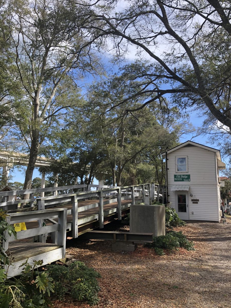
Bokelman, a founder of the Old Bridge Preservation Society, believes that the completion of the new bridge to Sunset Beach in 2010 was a demarcating line. Cars no longer had to wait 15 minutes or longer for the drawbridge to cross the waterway.
The new bridge was a sign that Sunset Beach was open to development like never before. If Sunset Beach is to grow substantially, however, that change will not happen overnight. Bokelman said that there are still undeveloped lots on the island and large stretches of protected wetlands.
Despite concerns with rapid growth, Sunset Beach remains a popular outpost.
The town has a museum located in the former bridge tender’s house, as well as Ingram Planetarium.
Sunset Beach has new roundabouts and housing developments that anticipate a greater influx of visitors and new residents alike. Myrtle Beach and Wilmington will likely grow to reach Sunset Beach’s boundaries if they continue on their present trajectories.
Until then, Sunset Beach is still a unique coastal town, one that is large enough to have amenities without high-rise development or cramped houses on the sand.


