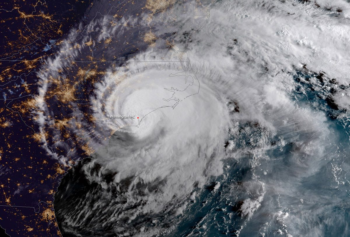
In September 2018, Hurricane Florence made landfall at Wrightsville Beach as a Category 1 hurricane. Tropical storms and Category 1 hurricanes are classified as “weak tropical cyclones,” and account for 70% of all tropical cyclones. Despite their name, weak tropical cyclones can still do a lot of damage — and their impact may be getting worse.
A recent study has shown that storms like this have been intensifying around the world from 1991 to 2020, something that scientists say is tied to global climate change.
Supporter Spotlight
The study, which was published in the journal Nature in November, included as a contributing author Dr. Wei Mei, assistant professor in the Department of Earth, Marine and Environmental Sciences at the University of North Carolina Chapel Hill. Mei and the research team found that in all ocean basins, weak tropical cyclones have been intensifying by 15-21%.

Storm intensity is not an easy thing to measure. Traditionally, tropical cyclone strength has been measured using satellite images, a method called the Dvorak technique. But using satellite data to calculate intensity creates information gaps.
“It consists of several steps that can introduce uncertainties because of the inherent subjectiveness,” Mei said. “As a result, the intensity of a tropical cyclone estimated by different trained meteorologists based on the Dvorak method can be very different, resulting in large uncertainties in the analysis of tropical cyclone intensity.”
Theoretical and mathematical models indicate that tropical cyclones intensify as surface waters get warmer — and research has shown that the oceans have gotten warmer and continue to warm. Unfortunately, satellite imagery cannot support the hypothesis of storm intensification in weak tropical cyclones, due to the interference of things like clouds and ocean spray. To find out whether or not weak tropical cyclones were truly intensifying, the research team would need to approach analysis of intensification trends using a different method.
To do so, the research team took advantage of the close relationship between ocean currents and storms. They used highly accurate current measurements taken by floating devices called surface drifters. These drifters were deployed by the National Oceanic and Atmospheric Administration, and they provided data that was able to complement traditional satellite imagery in quantifying storm intensification. The drifters were equipped with “holy sock” drogues, things that help stabilize the drifters’ position in the water. The drifters record measurements like location and water temperature, communicating that data to a satellite. Using the Ekman Theory, which is the understanding that winds transfer energy to surface waters and drive currents, the research team was able to estimate wind speed at a 10-meter height after identifying near-surface current speed. In other words, the scientists used their data on the ocean currents to calculate wind speed, therefore generating a better understanding of the storm intensity.
Supporter Spotlight
This new approach helped the scientists overcome the challenges of satellite imagery and shows that weak tropical cyclones have been intensifying during the three-decade study period. These results can help inform tropical cyclone models and increase their accuracy, which in turn can help coastal communities be better prepared for these kinds of storms. It is important for accurate information about weak tropical cyclones to be included in projections and models since weak tropical cyclones make up the vast majority of tropical cyclones.
It also helps scientists understand tropical cyclones in remote areas. And as more surface drifter data becomes available over time, the method used by these researchers can provide a much fuller picture of storm intensity and evolution.
According to Mei, there’s a link between this demonstrated storm intensification and climate change.
“Under global warming, the surface ocean gets warmer, providing more energy for tropical cyclones to develop and intensify,” Mei said. “Our earlier research has identified positive connections between ocean warming and storm intensification rate, particularly in ocean areas that are warming faster than other areas.”
What this means for coastal communities is that as the climate warms, tropical cyclones are expected to get stronger. Storms that may not have caused a lot of damage several decades ago are going to have a greater impact. This can make a critical difference for ecological communities — as shown in another recent study that theorizes that otherwise-resilient estuarine fish might have a harder time recovering from stronger storms — and human communities along the coast.
“The coastal communities need to be better prepared,” Mei said.

