New Hanover County commissioners will continue weighing development along the Cape Fear River’s west bank across from downtown Wilmington, a process that may be overshadowed if a portion of that land is annexed by a neighboring town.
Commissioners spent the better portion of a Thursday, March 31, work session discussing the future of the west bank of the Cape Fear and Northeast Cape Fear rivers asking questions of local, state and federal officials and geologists. The work session was held in a meeting room in the New Hanover County Government Center in Wilmington.
Supporter Spotlight
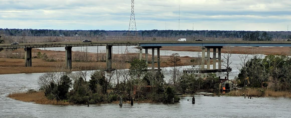
They focused their attention on land stretching between the Cape Fear Memorial Bridge and Isabel Holmes Bridge, and Eagles Island between the memorial bridge and the Thomas Rhodes Bridge on U.S. 421.
Developers are eyeing these areas, described as mostly private-owned, underused or vacated properties, for two major development proposals on land projected to be significantly impacted by the effects of sea level rise.
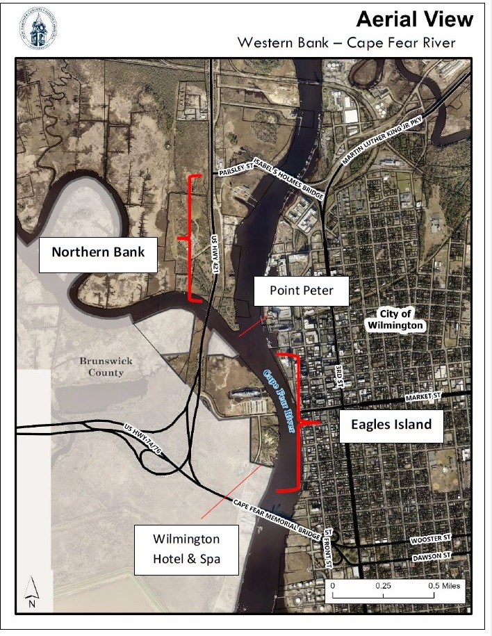
A good portion of last week’s discussions centered on the land’s exposure to flooding, safely accessing the property, the impacts of stormwater runoff from the proposed developments to surrounding properties, including the restored World War II battleship, USS North Carolina, a National Historic Landmark, and potential economic impacts.
Rob Young, professor of coastal geology at Western Carolina University and director of the Program for the Study of Developed Shorelines, referenced the number of nuisance flood days along that section of river bank.
“Right now, we’re around 80 days,” he said. “That’s a lot. That’s almost 25% of the year that area’s experiencing nuisance flooding.”
Supporter Spotlight
Young, who tuned in online to the work session to talk with the commissioners, said he wanted to make it clear that he was not taking a side for or against development on the west bank.
He told commissioners that while he was going to provide “a lot of cautionary thoughts,” he did not want anyone to interpret that as advocacy.
“You have to think of development as a system,” Young said. “This site is only as workable as your lowest point on any road that folks use to get in and out of there. It’s a little bit more complicated than simply thinking about putting a building on there and raising it above the base flood elevation.”
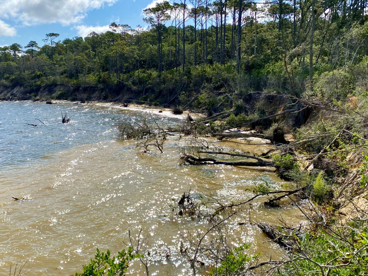
Point Peter, a peninsula that sits at the confluence of the Cape Fear and Northeast Cape Fear rivers, is “an incredibly exposed site so there’s no doubt in my mind that by 2050 that entire Point Peter area is going to be wetland,” he said.
About a year ago, KFJ Development Group presented plans for the Villages at Battleship Point, a proposed mixed-use development on Point Peter that would include a trio of condominiums rising 240 feet into the sky. For comparison, the former PPD building, the tallest in downtown Wilmington, is 193 feet high.
Earlier this year, New Hanover commissioners pressed the brakes on the developers’ request to create a new zoning district and rezone Point Peter within that district, opting instead to take a look at overall future development of the river bank adjacent to downtown Wilmington.
Related: New Hanover County commissioners table zoning request
KFJ took its request across the Cape Fear to Leland, where planning board members last month voted 4-3 recommending the developers’ request to create a River Urban Mixed-Use District to the town’s zoning district and annex the land.
Related: Leland Planning Board OKs riverfront mixed-use district
The Leland Town Council is meeting April 14, when it is expected to consider the planning board’s recommendations.
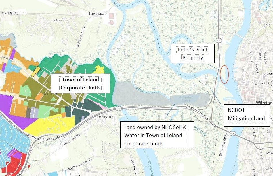
Jim Lea, a Wilmington attorney with KFJ, said in an interview after the work session that the development group is exploring “every opportunity we have and I’m not going to talk much more about that.”
“We think we need to get in front of people that want to make a change over there,” he said, referring to the west bank. “I think they do. But, it can’t be one-sided. We’ve got to be able to have a say and present our experts and present our case.”
KFJ has obtained a Coastal Area Management Act minor permit to remove debris from the property 75 feet landward of the shoreline.
Cars, tires, boats and steel have been removed from the site, which is just north of the Battleship North Carolina, according to Kirk Pugh, a real estate broker and KFJ partner.
“We’ve removed roughly 400 tons of trash and material off the property,” Pugh said last Thursday. “It was an 8.63-acre junk yard.”
The land was the longtime site of a marine salvage and construction operation.
Pugh said the development group has not asked for permission to build anything.
“We’re asking for permission to have the zoning to be allowed to pursue that,” he said.
“That’s exactly right,” Lea said. “That’s just step one and we realize that. We know that we’ve got to go and get permission for whatever we’re going to build. Otherwise, if we don’t, that west bank is going to keep looking like it’s looked for the last 42 years I’ve been here, which is not good for this community.”
Much of the west bank, including Point Peter, is currently zoned industrial.
Eagles Island is zoned commercial. A six-acre plot on the island, which is just south of the battleship, is being eyed as the site of the proposed Wilmington Hotel and Spa, a six-story building.
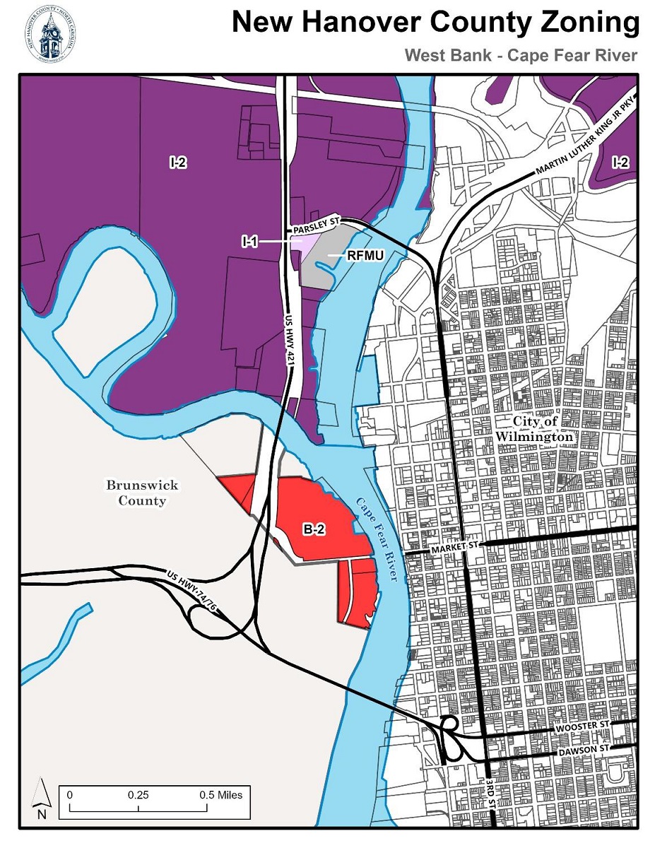
Those properties are within a Federal Emergency Management Area, or FEMA, flood plain, an area drawn up on maps that may be well outdated.
Young suggested the county compare FEMA flood maps of the area with data taken from storms that have hit the area over the course of the last 10 to 15 years.
“It would be very helpful for y’all to be able to put those FEMA numbers into perspective of what really happened,” he said.
The National Oceanic and Atmospheric Administration’s, or NOAA, latest report on rising sea levels, one Young called “the best scientific consensus report” thus far on the subject, projects sea level rise to be about one foot in the area by 2050, he said. That’s the same amount of sea level rise that has occurred in the area over the last 100 years.
“It certainly is appropriate that it’s in a flood zone,” Young said. “The FEMA maps, in this case, I would say are a starting point. They are not an overestimate. I promise you they are not an overestimate of the flood exposure of that area.”
As riverfront land, it is particularly vulnerable because it is exposed to water coming down the river and water coming up the river, Young said. He explained that, worst case scenario, water being pushed up the river by storm surge blocks flood waters coming down the river.
“These kinds of locations are particularly exposed to flooding because it’s not potentially coming from one place. It’s coming from two places,” he said.
Roger Shew, a geologist and earth and ocean sciences lecturer at the University of North Carolina Wilmington, told commissioners that they need to consider the fact that much of Point Peter sits at less than 4 feet of elevation, much of it is wetlands, and that, at one time, the property was all wetlands prior to urban soil being placed on the land.
He too stressed the impacts of sea level rise to the property.
Commissioner Rob Zapple asked whether a comprehensive hydraulic study was needed to determine the feasibility of managing stormwater runoff from development on the west bank.
Tara MacPherson, district manager of the North Carolina Division of Coastal Management’s Wilmington Regional Office, said the agency has not received such a study.
“If it’s included it’s great information for us to have,” she said. “We evaluate what’s proposed. We don’t have a proposal in hand. To address specific comments, we really need to see a site plan.”
Lea said KFJ asked if their experts would be allowed to speak at the work session and were told no.
“We recognize the concerns that were brought up” in the work session, Pugh said. “We’ve heard them all before over the past 12 months. We have our own sets of engineers and experts who have helped us create a project that answers all of the concerns and we are anxiously awaiting our turn to present our expert testimony in front of the commissioners and planning staff.”
An agenda for the Leland Town Council’s April 14 meeting had not been published as of press time.
Following the work session, Zapple noted that one member of the town’s council was at the meeting and that others had listened online.
“They’re hearing the same thing that we’re hearing,” he said. “Whether or not Leland decides to go ahead with the annexation is up to the town council, but I know they’re thinking very long and very hard about whether that’s appropriate or not.”


