Second of three parts
Evidence of the success of natural shoreline stabilization projects in North Carolina is starting to bridge the debate between proponents and skeptics.
Supporter Spotlight
A 2012 study of hardened and living shore-stabilization projects in the Outer Banks showed that natural shorelines outperformed bulkheads during Hurricane Irene. The strong category 1 storm made landfall near Cape Lookout on the morning of Aug. 27, 2011, bringing swift, powerful winds and heavy rain. Irene caused five deaths in North Carolina and caused more than $15 billion in damage from Florida to New York and the Caribbean.
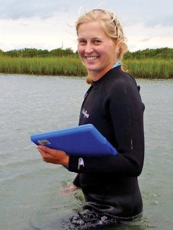
Thirteen months after the storm, Rachel Gittman, who at the time was a graduate student at the University of North Carolina at Chapel Hill, returned to various sites she surveyed in August 2010.
“I was able to show that bulkhead shorelines in particular had suffered damage from the storm,” said Gittman, now a postdoctoral research associate at Northeastern University in Boston.
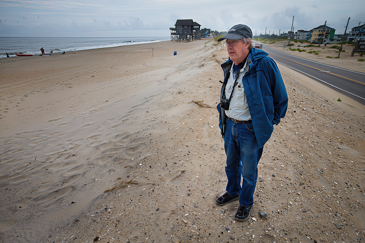
Bulkheads lined about 17 miles of the little more than 47 miles of shoreline surveyed along the back barriers of Hatteras Island and Bogue Banks. Irene’s storm surge overtopped many of the bulkheads she surveyed, eroding lawns and, in some cases, causing the walls to collapse.
Bulkheads surveyed in Frisco, Hatteras Village and Bogue Banks suffered the least damage, but in areas where the storm surge was greater and onshore sustained winds blew longer, bulkheads were torn away from land.
Supporter Spotlight
About 76 percent of a little more than a mile of walls surveyed in Rodanthe, Waves and Salvo either collapsed or suffered landward soil erosion.
“Damage to bulkheads was frequently observed directly adjacent or close to shorelines stabilized with riprap revetments, hybrid structures and sills that were not damaged, even along the Rodanthe, Waves and Salvo shorelines,” according to Gittman’s report.
Homeowners with natural shorelines essentially suffered no damage, she said.
Her research also found that, while natural shorelines may suffer temporary damage, they can recover without human intervention.
Bang for Your Buck
Because each shoreline is site specific, costs to install them are wide-ranging. Variables including location, bank grade and wave action all play a role in how much of and what types of materials are best suited to protect a shore.
They can cost as little as $70 a meter for marsh planting to $500 a meter for an offshore granite wall, or sill, combined with plantings. The average cost in 2011 to build a bulkhead or riprap revetment was an estimated $400 to $450 a meter, according to Gittman’s research.

While the initial expense, at least in some cases, to build a hardened structure or a natural shoreline is comparable, research is finding that maintaining and repairing a living shoreline is cheaper, noted Tracy Skrabal, a scientists with the N.C. Coastal Federation.
“Living shorelines do require a little more care upfront in the first couple of years because all living shoreline projects include a vegetative component,” she said. “They need to be cared for during the first, I’d say, two to three years, about the same as you’d care for a new lawn. Bulkheads actually require a lot more care over time.”
Bulkheads need to be replaced every 10 to 30 years. Living shoreline projects that have been monitored since their installation in the mid-1990s remain in “very good condition,” Skrabal said.
“The most maintenance that you would have over the years once a living shoreline is established is that, during big storms, debris can lay over your marsh and that debris would need to be cleaned up,” she said.
Repairing and replacing damaged bulkheads can set a waterfront property owner back thousands and are, therefore, the least cost effective method of shoreline protection, Gittman concluded.
Following the Money
Research from the federal level down to organizations like the federation continues to examine cost comparisons and the effectiveness and impacts of living shorelines.
The National Oceanic and Atmospheric Administration recently awarded the coastal federation a $570,000 grant to create living shorelines on public and private lands. Funding comes from NOAA’s Coastal Ecosystem Resiliency Grants Program aimed at strengthening the country’s coastal ecosystems and communities.
The project will create at least 2,000 feet of living shoreline on private and public properties. An estimated nine to 20 projects will be installed within the next three years.
Reefs will be built on the national wildlife refuges of Pea Island, Alligator River and Cedar Island. Other project locations include Carolina Beach State Park on the Cape Fear River in New Hanover County, Hammocks Beach State Park and Morris Landing in Onslow County, Trinity Center in Carteret County and Springer’s Point Park in Ocracoke.
Under the grant’s terms, the federation will establish and promote a cost-share program as an incentive to property owners who install living shorelines. The federation will also mentor at least three marine contractors, taking them through the design, permitting and construction process of a living shoreline.
These incentives are aimed at advancing public demand for living shorelines in North Carolina.
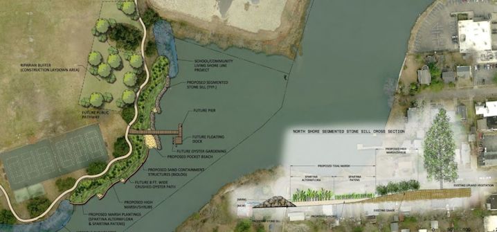
Educating and enticing private property owners to consider the natural shoreline protection alternative is an objective being discussed among regulators in Norfolk, Va.
That city in 2014 received a $4.5 million grant from the Department of the Interior to create living shoreline projects along about 2,000 feet of the Lafayette River.
Norfolk installed its first living shoreline in 1997 as part of the city’s wetlands restoration efforts. But it wasn’t until 2009 that the city’s living shoreline initiatives went on an upswing, said Scott Smith, senior design/construction project manager in the city’s public works department.
“We’re going after more grants and we’re investing more money,” he said. “I think the next step is getting to the private property owners, especially with the challenge of sea level rise as people are looking at alternatives. We haven’t got to that point of figuring out how to incentivize. That’s going to be our next step.”
Living shorelines the city has installed have “held up pretty well” during storms, he said. Each project was designed and placed so that it does not bare the full brunt of wave action.
The Right Shore
There are many benefits associated with living shorelines, researchers say, but they are not effective in all conditions.
The general consensus is that shores that encounter high, frequent waves are not good candidates for living shoreline projects.
“I believe that is an often repeated misconception that they don’t work in high-energy areas,” she said. “I could design living shorelines for more than 95 percent of the shorelines that I have visited.”
There are some places where living shorelines simply will not work, she said. The natural landscape of some areas makes it difficult for machinery such as excavators to access. Extremely high-energy waterways like Snow’s Cut in Carolina Beach are so deep and the current so strong that engineers cannot put structures in the water, Skrabal said.
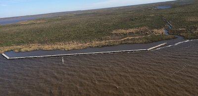
A new project in the works – one that will be the largest living shoreline project in North Carolina – will test the technique’s durability on a waved-buffeted shoreline. SEPI Engineering in Wilmington is in the process of bringing a new type of structure to North Carolina to build a nearly mile-long living shoreline project along the Cape Fear River in front of the Brunswick Town State Historic Site.
The engineering firm has received a Coastal Area Management Act, or CAMA, major permit, a process that took about a year and a half, to install the project.
The project will incorporate an offshore breakwater designed to allow tidal flows to pass through “reefmakers,” special concrete pilings created by Alabama-based Walter Marine, the largest artificial reef builder in the U.S.
“They’re on pilings and they’re stackable concrete discs with rock in them,” explained Randy Boyd, SEPI project engineer. “They allow the water through so you have a flushing action that allow marine life to go through, but they knock down the waves. That’s what we designed for, is those impact waves, because it is really tearing the shore up.”
The waves are destroying the pre-Revolutionary port, ripping away centuries’ old artifacts.
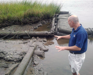
“We started monitoring our waterfront in 2008,” said Jim McKee, Brunswick Town site manager. “We started noticing archaeological features washing out. At first we were thinking Civil War wharf. As more and more was washing out we realized it’s colonial. We can’t even imagine what we have lost”
Researchers at the University of North Carolina at Wilmington have reviewed and compared aerial photographs dating back to the 1930s of the site. Those photos show that since 2006, the historic site’s waterfront has lost upwards of 70 feet to 120 feet, McKee said.
“It’s a combination of factors, but the underlying one, I have to say, is ship traffic,” he said. “It’s just the accumulation of size and speed of the ships, but when there’s times of light traffic, especially in the summer time or when we’re doing work and we request ships slow down, you see the waterfront start to rebuild itself. It’s unreal how fast it heals itself.”
Recognizing the shore’s ability to restore itself, engineers decided to steer away from installing an offshore revetment, an earlier proposal presented to the historic site’s officials in 2012.
A riprap revetment would require a base 60 to 100 feet wide, McKee said. The “reefmaker” system is a fraction of that size.
The estimated $6 million natural shoreline protection project will be built in three phases. The last one will include marsh planting.
McKee sees the project as an opportunity to protect the shores along the historic site and serve as an educational tool that will promote eco-tourism.
“Honestly I can’t see any drawbacks from it,” he said. “It’s a no-brainer. It really is.”
Though construction hasn’t begun, the project has already drawn the attention of those curious to learn more about the science behind it, said Jason Hales, SEPI Engineering’s environmental project manager.
“Living shorelines are the way that the science is going for shoreline stabilization and we’re trying to support that effort,” he said.
Collective efforts are being made to get grants that will allow researchers at UNCW to closely monitor the project.
To Learn More
- NOAA’s “Guidance for Considering the Use of Living Shorelines”
- Brunswick Town erosion project
- Lafayette River project
Wednesday: Streamlining the permitting


