Reprinted from the Island Free Press
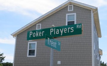
OCRACOKE — Who is “Mark,” and why does he have a path named for him on this island? Where’s the poker game on Poker Players Lane?
Supporter Spotlight
Streets in Ocracoke have sometimes quirky, sometimes obvious — Creek Road — even ho-hum names, such as North Street or Middle Road.
While Ocracoke has had European settlers since the 1700s, the island got official street names only in 1999 to make it easier on emergency responders.
Up until then, the sandy lanes were known for what they were used for, said Roger Garrish, manager of the Sand Dollar Motel on Sand Dollar Road.
The committee in 1999 wanted to call Sand Dollar Road “Circle Road,” but when Garrish found out he petitioned to have it changed to its current name “because of the motel.”
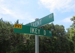
Who is “Ikey D?” Garrish said Ikey D. O’Neal was a master carpenter who worked for island builder-developer Sam Jones back in the mid-20th century. “Ikey built the (original) Castle,” he said.
Supporter Spotlight
Ikey D is also the name of Sam Jones’s horse, buried beside him along the Springer’s Point path, and Ikey’s son, also named Ikey, still lives on Ikey D Road.
Islander Candy Gaskill, recalls that some island men would go drinking down off O’Neal Drive in the current Trentwood area, and the elder Ikey was one of them.
“When Ikey D drove by around 3 p.m., I knew it was time to go home,” she said.
When the first pass at the street names came out, she saw that the road by the lighthouse was to be named “Point Road.”
“When we heard about that, me and Dale (Mutro) threw a fit because it’s always been called Lighthouse Road,” she said. “That wasn’t ‘the Point.’ When we say, ‘We’re going to the Point,’ we mean South Point, not Springer’s Point.”
Lighthouse Road becomes Loop Road around the entrance to Springer’s Point, but that section of the road was once called Moonlight Valley Road, Candy Gaskill said. This name is noted on a 1997 Ocracoke Village Development Ordinance map.
Sunset Drive was most recently known as Firehouse Road because the firehouse was there at the intersection of Back Road.
Before that, it was Ammunition Dump Road leading to a site toward Oyster Creek where there were 10 to 12 ammunition bunkers during World War II.
Chester Lynn thinks Sunset Drive should still be called Ammunition Dump Road.
The first paved road on the island was the road in front of his house, Back Road. “It went from the (former Navy) base all the way down to the ammunition dump,” he said. “History should not be lost.”
It was a dirt road before the pavers arrived, said Darlene Styron, owner of the Sweet Tooth, who was on the original street-naming committee. “We used to dig up glass bottles from the war there,” she said. “A lot of the names are self-explanatory, such as British Cemetery Road.”
With the arrival of the 911 emergency response system, street names with signs were needed so that EMS responders could find places.
“The county had preliminary names and asked us to review them,” she said.
After the committee made the street names public, several islanders petitioned for different names.
A lot of the names are for people who owned the properties or who lived there, said Kenny Ballance, who also was on the original committee.
Martha Jane Lane off Lighthouse Road was for a woman who lived along the road.
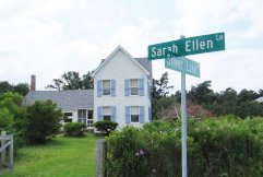
Sarah Ellen Gaskill has both a lane, in the Down Point area, and a drive, off Trent Drive, named after her.
“She lived Down Point,” said Clayton Gaskill, a grandchild of Sarah Ellen, who died in 1984. I would visit her every summer.”
One of her kin lived on the other side of the island and wanted to remember her as well, he said.
So Sarah Ellen got a drive on the other side of the island – near “Arretta Street” and “Bebe Lane,” who all were friends, according to Gaskill.
He surmised that because their men were away working off island, people would refer to these ladies’ houses by their first names instead of the family names.
Perhaps because so many island families — Gaskill, Gaskins, Garrish, O’Neal, Howard, Williams –intermarried and are still related, it was like one big clan.
When talking to native islanders about who’s who, one’s mind starts to reel as they rattle off the circular linkages: “That was my daddy’s cousin’s wife’s aunt.”
“We’re all mixed in,” said Roger Garrish with a laugh.
“Mark was my great-grandfather Markus Gaskins,” noted Ballance about Marks Lane, off Back Road, where Markus had lived.
Miss Elecia lived across the street from Ballance, and she was the island seamstress.
“Water Fired Lane,” off Lighthouse Road, was a term islanders used for bioluminescence that sometimes illuminates the surf in certain conditions.
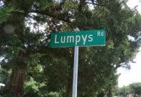
Was “Lumpy” a person commemorating “Lumpys Lane” between Cabana Drive and Friendly Ridge Road?
Baby Boomers of a certain age might be reminded of one of the characters on the “Leave it to Beaver” show of the 1960s, but there was no islander with that name.
“It was named that because it was just a lumpy road,” Styron said with a shrug.
But the poker players were real. “They were island men who would hide from their wives and play poker down there on fish boxes,” said Rudy Austin, who said he couldn’t remember who the particular men were. “We used to crawl over there and watch them. Then they’d run us off.”
There are three streets named Cedar — Lane, Road and Drive.
Ocracoke Commissioner John Fletcher is seeking that these streets be changed to specific cedars (such as White Cedar, or Red Cedar) to differentiate them for EMS dispatchers, as frantic callers might not know which Cedar they’re on. This is especially crucial when Hyde County merges its EMS dispatch with Dare County in three years and the dispatchers are in Dare County.
Retaining some of the old names was essential to the island street-naming project, Austin said.
“That’s the only way you preserve stuff,” he said.
As for other unusual names:
Nubbins Ridge—No one knows why it’s called that. “It’s always been called that,” said Gail Hamilton, who’s lived on the ridge all of her life. Several O’cockers questioned didn’t know why it was named that.
There really is no ridge. This part of the island, along with Friendly Ridge, off Sunset Drive, and Brugh’s Ridge, off Cutting Sage, are high spots on the island.
Winnie Blount Road—Winnie and her husband came to live on the island after the former slaves were freed following the Civil War. Bryant Lane also was named for an African-American family who owned all the property in the area of the lane.
Irvin Garrish Highway—Ocracoke’s first elected official, a ferry captain and Van O’Neal’s grandfather.
Boos Lane–is named after the Boos family, who live nearby.
Cutting Sage and Cutten Sage: Kenny Ballance said the first street was named “Cutten.” Then other residents petitioned to have a street named in correct English, or “Cutting Sage,” which connects to Cutten Sage.
Pilot Town Road at the ferry dock: Ocracoke was first called “Pilot Town” after the many Colonial ship pilots stationed here.


