 |
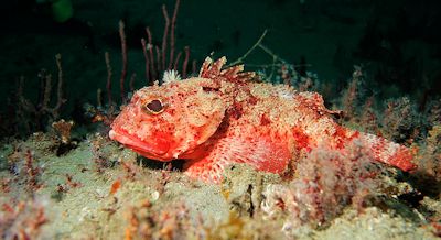
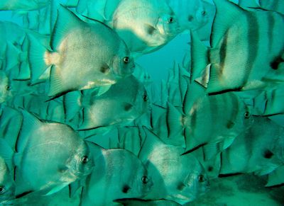 Scorpion fish, top, and Atlantic spadefish are just of few of the species found on a reef off Wilmington. Photos: UNC Institute of Marine Sciences Scorpion fish, top, and Atlantic spadefish are just of few of the species found on a reef off Wilmington. Photos: UNC Institute of Marine Sciences |
PIVERS ISLAND – It is the Age of Information. Reams of data, from personal bank account balances to the chemical composition of Antarctic ice cores, are keyboard clicks away. Satellites now see all, and remotely controlled crafts plunge to the darkest depths of the seas and return with pictures of strange, creepy creatures.
Yet, there is this startling irony: We know very little about the ocean floor just off our coast.
Supporter Spotlight
“We come to find out that less than seven percent of the coastline of North Carolina, from the coast out to the continental shelf break, has been mapped or described in any way,” said Chris Taylor, a research ecologist at the National Oceanic and Atmospheric Administration’s Center for Coastal Fisheries and Habitat Research on Pivers Island near Beaufort.
No one, it seems, really needed to know what’s out there. Now, they do.
The federal government has designated three areas off the N.C. coast as potential sites for large-scale wind energy development. It would be prudent to know something about the ocean floor before the huge turbines go up.
Scientists like Taylor are looking. He is one of the principal investigators in a study funded by the federal Bureau of Ocean Energy Management to find out where critical fish habitats are within an area that the federal agency will potentially lease to offshore wind developers.
To get the job done, Taylor’s team employed expensive seafloor mapping sonar technologies, sent divers to the bottom and spent several weeks at sea. They surveyed 277,000 acres, which covered an area for possible wind-energy leasing, southeast of the port of Wilmington, known as Wilmington-East. Taylor said he was mostly impressed by how the offshore reefs cluster like oases in what appears to be a vast oceanic desert — one that covers over 95 percent of Wilmington-East and that scientists know very little about it.
Supporter Spotlight
“I think that’s what I’ve learned — and I think it’s been one of the greatest findings that we have from this project — is that there’s really localized areas of hard-bottom reefs and then there’s this vast desert that we don’t know much about at all,” Taylor said.
Just as deserts on land are important ecosystems that provide migratory corridors, so do the ones down below. Taylor said that sand shoals and sand waves are important habitats for spawning fish, like cobia and red drum, and provide avenues for moving offshore. “We need to understand [that] maybe some of those sand features are also important habitats like we see the obvious importance of these hard-bottom reefs,” he said.
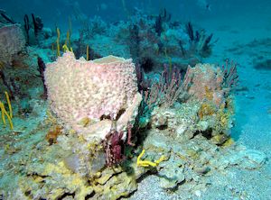 The vase sponge is one of the worlds most colorful sponges. They are invertebrates, which means they don’t have a backbone. Predators do not eat them because they lack nutrition. Photo: UNC Institute of Marine Sciences |
“They just look like sand waves to us, but there’s probably something very specific about them that the fish are cuing-in on that we have yet to learn,” said Taylor.This research was prompted by a gap in understanding what effects wind turbine farms might have on the ecosystems of high-value fish, he noted.
“There’s a very valuable recreational-commercial fishery offshore that focuses on snapper and grouper. They’re at risk of overexploitation and at a high risk for fisheries management; and the habitats that they reside on are sparsely distributed along the coastline, and we don’t really know where those are,” said Taylor.
Also, as it turns out, it’s easier to install a 500-foot wind turbine on a flat, sandy surface than a on a reef.
“Our understanding is that a good place to put a wind turbine is somewhere that’s flat and sandy; that they can either put an anchor base or they can pile drive into the sediment. They would not want to put it on something that’s hard and rocky, primarily for the impact that it has on the habitat but also because it just becomes more challenging to execute that engineering,” Taylor said.
It took 30 days, 24 hours a day, painting the seafloor in half-mile-wide swaths of sound waves, going back and forth as if mowing a lawn. The side-scan sonar creates a black-and-white, photo-like image of the seafloor, which is often used to detect the texture of the seafloor and objects like reefs or shipwrecks.
This gave the researchers an indication of where the hard-bottom reefs were, but they couldn’t be sure. “So we had a larger mission that dropped divers in the water and used a more expensive multi-beam sonar,” Taylor said.Multi-beam sonar creates a rainbow-colored map of the seafloor’s depth. Red is used to show shallower depths and blue-violet for deeper water. The divers compared the images created by the sonar technology to confirm whether a structure is a reef or something else.
“There’s a lot of area within this proposed wind energy field that do not contain these sensitive hard-bottom habitats. That’s what we think, based on our observations so far,” Taylor concluded.
Gathering this expert input is part of BOEM’s “Start from the Start” initiative, which is designed to identify suitable areas for wind-energy leasing and to inform developers’ decisions in choosing sites with sound research.
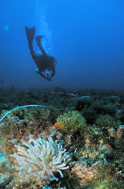 A diver does transect surveys of a reef. Photo: UNC Institute of Marine Sciences |
“The N.C. Wind Energy Areas were delineated with the intent of providing protection of ecological sensitive areas and minimizing user conflicts while making available commercially viable areas for offshore wind development,” wrote BOEM spokeswoman Tracey Moriarty in an email. “By doing so early in the process, the time and cost associated with the permitting, construction and operation of a wind facility within these areas will be significantly reduced.”UNC Chapel Hill’s Institute of Marine Science in Morehead City is a partner in this research effort. The academic team is synthesizing all available information about how stakeholders use the wind energy areas – be it navigation, fishing, diving, recreation, commerce – as well as surveying offshore reefs seasonally to create a baseline of information.
“The hard-bottom habitat data will be needed later in the process if a developer submits a construction and operations plan. The process can move forward without this information, but no actual development would be able to occur until full surveys and identification are done for all areas being considered for development,” Moriarty wrote.
Scientist can envision negative and positive effects from wind turbine farms, said ecologist Chris Taylor. One such negative example, he says, is the immediate effect of the construction.
“You can imagine a disturbance of pile driving into the sediment, and if you’re in close proximity to a reef there might be debris that would float from the pile driving or the dredging or from anything when you’re placing the infrastructure,” he said.
Depending on the currents and how the water is moving, that could affect the hard-bottom habitats within a certain proximity. Also, there’s the potential for the way water moves and delivers nutrients to change, though, he said, it is still unknown how close the turbines will be to the natural reefs.
A positive effect wind turbines could have on the ecology, Taylor said, is that rocks anchoring the turbines to prevent erosion could create artificial reef habitat for fish.
“[Artificial wrecks] holds some of the largest fish that you can see out on the reef habitats off North Carolina,” he said. “So it could be that these wind turbines provide new habitats that provide new places for fish to reside, grow, reproduce and protect from predation.”
Whether this would prompt more population growth or displace fish from their natural habitats to the artificial ones, “that we don’t know,” said Taylor. “I’m not sure we can make those predictions yet.”


