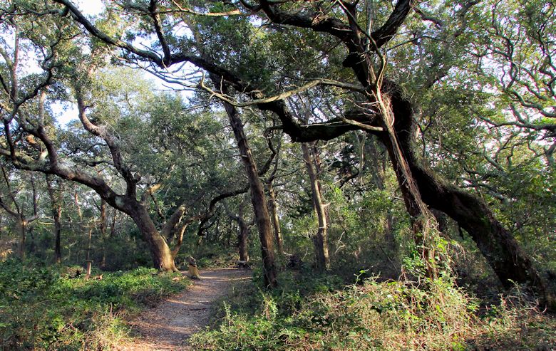
Springer’s Point Nature Preserve is marked by winding trails through lush maritime forests of gnarled live oaks and red cedar.
Supporter Spotlight
The winter beach was deserted except for a few frozen fishermen. |
How cold was it? So cold that ice formed at the base of the marsh grass. |
Last of two parts
OCRACOKE — Ocracoke Island is one of those places along the N.C. coast that I love to visit, but it’s always during the hot muggy days of summer or the crisp delightful days of fall. However, recently, on a whim, I decided to take the trip across Pamlico Sound on one of the coldest days of the year. It was so cold that even the hardiest of watermen left their boats secured to the dock and sought a cozy refuge of warmth from a biting wind. During the ferry ride from Cedar Island to Ocracoke, not a single boat was seen plying the waters.
Photos by Sam Bland |
On its approach to Silver Lake, the ferry route offered a good view of the inlet, island and village we all know today as Ocracoke. Early maps indicated that this area was known as Wokokon, which is the derivative of a Native American word that refers to the name of a tribe near the Neuse River or suggests that the area could have been some type of native settlement. It is also proposed that Wokokon was a native word meaning a barrier island near an inlet. Over the years, this phonetic sound was spelled “Ocracoke” and is pronounced by saying the unpopular vegetable and the popular soft drink as one word.
Supporter Spotlight
The origin of the name Ocracoke has even been attributed to Blackbeard. In the early morning hours on the day that the notorious pirate lost his life in an epic fight with the British Royal Navy, Blackbeard was restless for the impending battle. It is said that he beseeched the rooster onboard his ship to announce the birth of a new day, pleading “O Crow Cock” numerous times. Say it fast and it sounds like Ocracoke.
Some maps indicated that Wokokon was at one time part of Portsmouth Island while others have it connected to Hatteras Island and called it Croatoan. Ocracoke was even once designated as part of Carteret County rather than Hyde County.
My truck was the last of only three vehicles on the ferry, and I headed about a mile down the road and parked on the highway shoulder at the entrance of beach access ramp 72. Even though the skies were sunny, the cold temperatures required many layers of clothing to ensure that I wouldn’t go running back to the truck, crank up the heater and head back home.
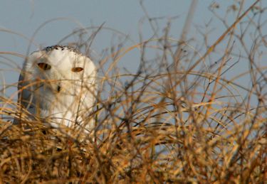
A snowy owl poked its head through the grasses at the top of a dune. |
Bundled up as if I was about to summit Mount Everest, I began hiking down the long sandy road towards the ocean. Moisture in the sand had frozen hard and crunched like gravel under the weight of my boots. On both sides of the trail, the wetland grasses were stiff and rigid and unable to sway in the wind as they would on a warm, balmy day. Nearby, the surface of the narrow shallow tidal creeks was crusted with a thick layer of ice. Here and there, I could see where nutria, the large rat-like mammals, had broken the ice to gain access into or out of the creek.
As I neared the ocean, I began to hear a low thunder-like rumble that caused me to scan the skies for an improbable thunderstorm. As I crested the dunes, it was obvious that the false thunder was produced by large waves, their size betrayed by an offshore wind that pushed away the sound as they crashed onto the shore.
Out on the beach, I was surprised to see a couple of vehicles off in the distance along with the silhouettes of a few people surf fishing. I wandered down the beach, with the sun reflecting brightly off of a sparkling ocean, looking for any signs of wildlife when a white patch atop a grassy dune caught my eye. With its head poking above the grasses like a periscope, a snowy owl kept me under surveillance. I had heard that one, maybe even two, of the wandering snowy owls had been sighted on Ocracoke Island, but I didn’t expect to stumble upon it so easily. I hunkered down in the dunes out of the wind and was able to get a few photographs. The bird eventually flew a short distance to another perch as a lone vehicle rumbled down the beach.
With the wildlife scarce, I left the beach and began the long hike back down the ramp road. Out in the marsh, I spied a lone brownish colored bird secretively and delicately tiptoeing through the grasses then suddenly slipping into the protective cover and out of sight. This bird, a clapper rail, is not often seen. However, during the summer, its presence is obvious as this salt marsh provocateur produces a number of loud and obnoxious calls. Some avid birders attribute the saying “thin as a rail” to this skinny bird over the more reasonable origin related to the rail of a fence.
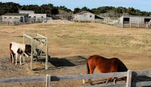
Over the years the wild horses of Ocracoke were used by islanders for work and recreation. |
Back at the truck, I turned the heater on high and drove north on N.C. 12. Not far down the road a series of short tidal creeks cut into the back side of the island and provided a safe anchorage for a few small fishing skiffs. These creeks were most likely formed many years ago by the pounding hurricanes that cut inlets through the island. As sand closed the inlet on the ocean side, a tidal creek fed by the Pamlico Sound remained.
Farther north, the island narrows and the beach dunes are right beside the road. I parked the truck and hiked a few yards to the top of a dune and the beauty of the island smacked me in the face. A long ribbon of white sand bordered by turquoise water and blue skies reached out to the northern horizon. I soaked in the exquisite view for a few minutes before the sting of the cold chased me back to the truck.
I headed back towards the village and along the way made a stop at the180-acre pony pen where around 30 of the famous Outer Banks ponies are cared for by the National Park Service. Most of Ocracoke Island is part of the Cape Hatteras National Seashore, and thus, the horses are considered a natural and cultural resource that is under its management. These ponies are thought to be descendants of Spanish mustangs from Spanish and European settlements or shipwrecks as early as 1526. Over the centuries the settlers on Ocracoke used the ponies for work and recreation. They were used by the Life Saving Service, the Coast Guard and the Ocracoke Boy Scouts. Even the park service rangers now use them from time to time to patrol the beach.
Back in the village, I submitted to a mandatory compulsion that requires me to stop at the iconic lighthouse and snap a few pictures whenever I visit the island. A friendly cat escorted me down the boardwalk to the base of the white 75-foot brick structure, which was built in 1823. Its stationary beacon reaches 14 miles in all directions to guide mariners. Even with all of the maritime technology available to assist boaters, the lighthouse is more than a historic symbol of Ocracoke. As the second-oldest operational lighthouse in the country, its signal is still a comforting sight for those sailing the waters of the Graveyard of the Atlantic.
From the lighthouse, I made a short hike to what I consider to be the jewel of Ocracoke Island, Springer’s Point Nature Preserve. This is a 120-acre site of significant natural beauty that also figures prominently in the history of Ocracoke. It was preserved by and is now managed by the N.C. Coastal Land Trust. Heading down the sandy path bordered by the maritime shrub thickets of wax myrtle, red bay and yaupon, I quickly leave behind the homes and businesses of the village and feel like I am in a wilderness area. Eventually the trail is completely encased by a maritime forest canopy of live oaks and red cedar. The branches of the live oaks are gnarled and twisted creating outrageous shapes while the trunks of the cedars are some of the biggest I have ever seen. During the spring and summer, a portion of the preserve is a rookery where egrets, herons and ibis will build nests and raise their chicks.
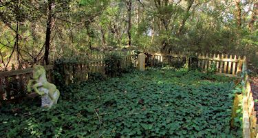
A fenced plot at Springer’s Point marks the graves of Sam Jones and his horse IkeyD. |
This plot of land was once called Teach’s Plantation and is where Blackbeard, whose real name was Edward Teach, come ashore with his crew while waiting to pounce on merchant ships sailing just past the inlet. The waters just off this southern point of the island were deep enough for Blackbeard to anchor his ship and became known as Teach’s Hole. Here, Blackbeard would secure his boat, come ashore and hold parties of feasting, music and dancing for days on end. At times, other famous pirates such as Calico Jack were invited to join the festivities.
It is one of these parties that distracted Blackbeard from noticing the arrival of Lieutenant Robert Maynard of the British Royal Navy just outside the inlet. The following morning, Maynard and the ships under his command battled Blackbeard and his crew. Blackbeard was killed and his head lopped off. Ever since, goes the story, people have seen a mysterious light, known as Teach’s Light, hovering above the waters or through the trees as Blackbeard looks for his head around Springer’s Point.
With Blackbeard no longer a threat, the area became known as Pilot Town since it was inhabited by boat pilots who served as local guides for ships that needed safe passage through the tricky inlet to access mainland port towns such as New Bern and Elizabeth City.
The hiking trail continues to the open shores of the sound that overlooks Teach’s Hole then loops back into the forest. Here in the forest, you can find a tiny cemetery enclosed by an old wooden fence covered in ivy. Inside are one head stone and a small statue of a horse. This is the grave of Sam Jones, a man who once owned Springer’s Point and was a prominent Ocracoke figure for many years. Jones was a conspicuous and fascinating man who was known to bring his beloved horse, IkeyD, into his house to join the family as they sang songs around the piano. What about the stone horse statue in the cemetery? Well, it marks the grave of IkeyD, where, as requested, Jones was buried beside his companion.
Even though Springer’s Point is known for its haunts and apparitions, it did not seem spooky at all. The only thing haunting about Springer’s Point is the captivating beauty of the forest that will lure you back for another visit.
All of my visits to Ocracoke have been centered around its stunning natural resources. Yet, its cultural history is equally stunning as well. There are many other stories of this fascinating place, such as the time bananas washed ashore for weeks or how Molasses Creek got its name. For those wanting to know more about the history of Ocracoke Island beyond my brief attempt, I suggest the book by island native Alton Ballance titled Ocracokers.
As I rode the ferry back to Cedar Island, a spectacular sunset graced the western sky, one of the most amazing that I have ever witnessed. It was the exclamation to a glorious day. I thought of what an exceptional place Ocracoke was, and is today. The “Ocracokers” have a legacy, a culture and a natural playground that, as a visitor, I am envious of.
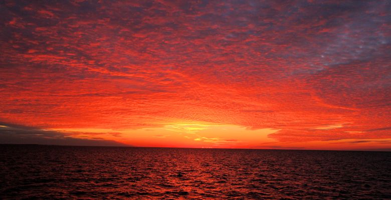
A stunning sunset over Pamlico Sound marked the end of a glorious day.


