MOREHEAD CITY — As Hurricane Irene moved up the East Coast just about a year ago, Joseph DiRenzo, the chief of operations analysis for the Coast Guard Atlantic Area, placed a phone call from his office in Portsmouth, Va., to Rick Luettich, director of the University of North Carolina’s Institute of Marine Sciences in Morehead City.
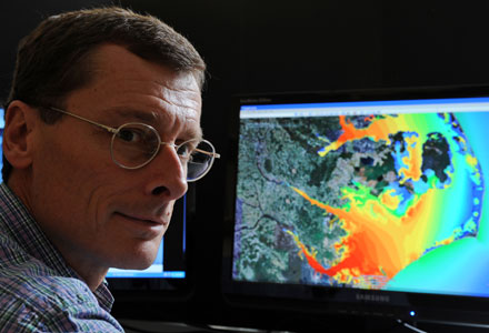 Rick Leuttich pioneered work on a powerful system of computer models that accurately predicts a hurricane’s storm surge. Photo: UNC |
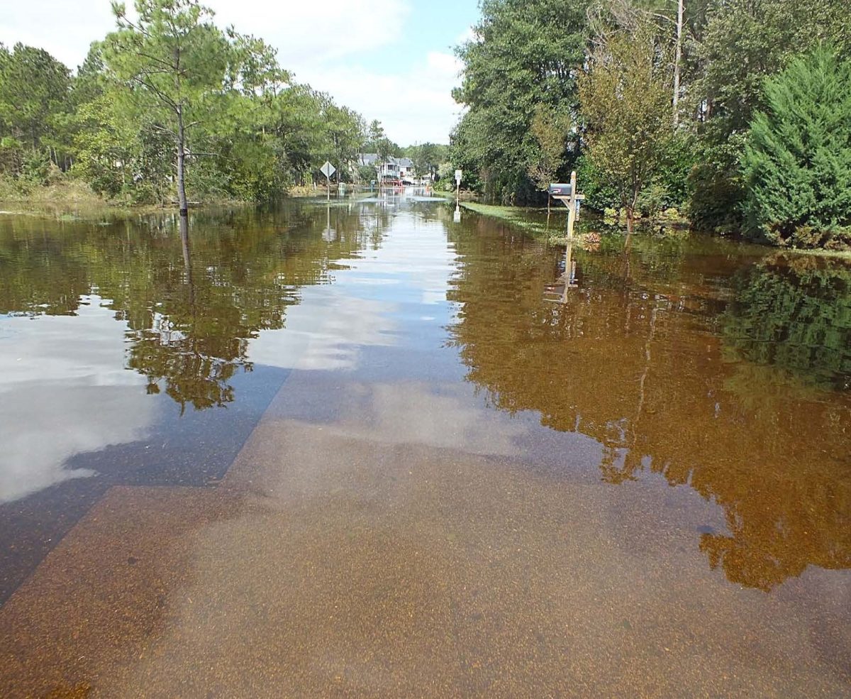
DiRenzo was worried about the Portsmouth base, which is the Coast Guard’s command center for the Atlantic. It sat on very low ground that was prone to flooding. Though Irene wasn’t forecast to become a major hurricane, the famous five-category scale used to distinguish storms is based on sustained winds. It says nothing about a storm’s most-dangerous feature—its surge of flood waters. DiRenzo wanted to know what kind of storm surge to expect in Portsmouth.
Supporter Spotlight
That phone call turned out to be the key decision in a string of moves that helped keep the Coast Guard fully operational as Irene, a big storm but only a Category 1 hurricane when it made landfall in North Carolina, surprised many, wreaking havoc along the Eastern Seaboard all the way into New England.
DiRenzo had served on an advisory board for the U.S. Department of Homeland Security’s Coastal Hazards Centers of Excellence, a consortium of hundreds of universities that work on ground-breaking technologies. UNC is part of the network. DiRenzo knew Luettich, having bumped into him many times over the years at meetings. More importantly, he knew of Luettich’s involvement in developing and pioneering a system of computer models that’s remarkably accurate in turning raw data – hurricane wind speeds and paths – into predictions of the amount of storm surge that might be expected in specific locations.
At DiRenzo’s request, Luettich ran the Advanced Circulation Models, or ADCIRC, on powerful computers in Chapel Hill. It was quickly evident there would be problems in Portsmouth.
 Joseph DiRenzo |
In fact, Luettich said recently, the models indicated that the base would be inundated. Forewarned, base commanders in Portsmouth loaded two C-130 aircraft, one carrying command staff, and flew them to St. Louis to ride out the storm and control Coast Guard operations from Missouri, 900 miles away. Not too long after that, the base was indeed flooded by storm surge and lost power.
It was not, however, the first time the U.S. government had made use of ADCIRC. Luettich said the Army Corps of Engineers has made extensive use of the program’s modeling capabilities to guide construction of new levees and other flood control measures in the New Orleans area in the wake of the devastation caused by Hurricane Katrina in late August 2005. Billions of dollars worth of construction have been based on ADCIRC models’ predictions of how future storms will likely impact the region.
Supporter Spotlight
ADCIRC has been a long time coming.
“Every since I’ve been at UNC, about 20 years, I’ve been working on programs to predict how the coastal ocean moves,” Luettich said. “I’ve been interested not only in how and where the water moves, but also the movement of fish larvae and contaminants in the water. As this program has evolved, it has improved to the point where it is useful to a variety of agencies.
“It’s not the first of its kind, but it does represent a major leap forward,” he said. “Previous programs were smaller and limited.”
A key difference, Luettich said, is the extensive underlying database developed for and used by ADCIRC.
“The basic software – the algorithms – has stayed basically the same, but our underlying database is now very site-specific,” he said. “In the greater New Orleans area, for example, we worked down there for four or five years.”
The researchers – Luettich’s prime collaborators are at Notre Dame – have used topographic and other crucial data from a wide array of sources, from federal agencies — NOAA, Army Corps of Engineers, for instance — down to the county level.
As is the case for most “products,” improvement has been driven by demand. As more people and more agencies have used ADCIRC data, they’ve wanted more out of it. To provide that, Luettich and his team, including graduate students, have had to continually refine and improve the program, which can be, and has been, used in crucial decisions about whether to move large vessels to safer places as storms approach.
“Those are big decisions,” Luettich said. “It costs a lot of money to move ships, hundreds of thousands of dollars. You can just say, ‘Move everything and play it safe,’ but that’s expensive.”
The program helps those in charge make those decisions with more confidence, based on what should be more accurate and location-specific decisions than in the past, he said.
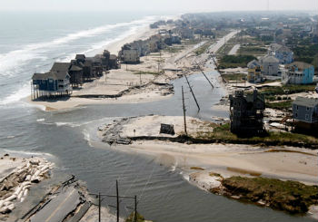 Hurricane Irene’s storm surge carved several new inlets along the Outer Banks. |
ADCIRC, Luettich said, is now used by the Federal Emergency Management Agency and consultants from New England south and west to Texas. It’s becoming standard practice.
The program does not obviate the need for data and predictions from the National Hurricane Center and NOAA’s National Weather Service, Luettich emphasized. In fact, the program uses that data.
“We grab the advisories the National Hurricane Center generates for storms every six hours – wind speed, wind fields, predicted paths, wave heights, things like that – and use them to drive ADCIRC,” he said. “We did that for each one they sent out for Irene. Our goal has not been to supplant what the others do. What we do is ‘value-added.’”
Luettich and his team are in the process of spreading the word about the capabilities of ADCIRC to emergency managers in coastal North Carolina. He stressed that ADCIRC requires vast computing power, almost that of a “super-computer,” so it’s not something local emergency managers can do on their own. During Irene, he said, the institute in Morehead City lost power, but he was able to look at results of the program in Chapel Hill by using his battery-powered IPad.
But, Luettich said, UNC will, on request, run the program for specific areas and place the results on the program’s web site. While there, casually interested viewers can select storms – such as Earl in 2010, Irene in 2011 or Beryl in 2012 – and run animations to view surge heights at various times.
Luettich said the information can be very valuable on a local level, where managers must try to quickly make sense of very complicated situations and scenarios. For example, storms’ impacts are very tricky to predict on the back side of barrier islands in North Carolina’s Pamlico Sound, which is virtually an inland sea. Hurricanes can literally blow water away from those shores one minute, to the point where the sound is “dry” a half-mile or mile offshore, then quickly flood those same shores when the wind shifts as a hurricane moves past.
And Luettich plans to continue to improve the program.
“What we want to move toward is being able to develop an ‘ensemble’ of storm scenarios, where we can take a storm forecast, and, say, move it a little to the left or a little to the right, then maybe run it 20 percent stronger than predicted,” he said. “Storms are very unpredictable, as all of us here on the coast know. Predictions have improved greatly, but the storms can wobble, they can strengthen and weaken quickly.
“What we want to be able to do is take the predictions and do variations. If we can do that, and then present a half dozen or maybe 10 variations, then we’ll be able to look at a forecast and then just click through the plausible alternatives. We think that will be very useful.


