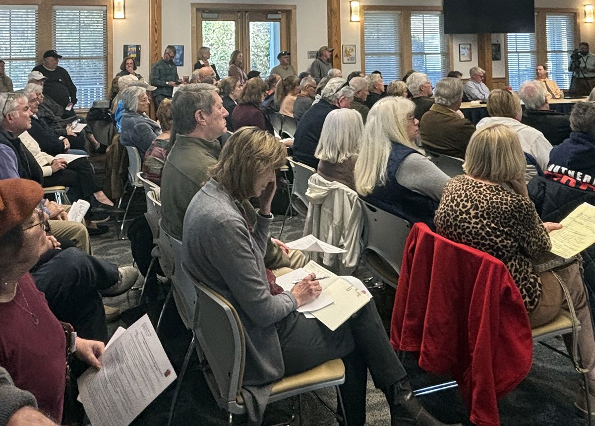
DUCK — Fifty years after the need for a bridge between mainland Currituck County and its barrier island beaches was first identified, and 30 years after a draft planning document for the proposed mid-Currituck bridge was first released, a recent public meeting revealed that the same issues are still being vigorously debated, costs have skyrocketed, and funding is still lacking.
Even with the green light in 2019 to finally begin the permitting process, the project continues to face considerable hurdles, including stark disagreement in the communities the bridge would connect.
Supporter Spotlight

Attendees at a recent hearing in Duck told state officials the bridge was needed to relieve the bumper-to-bumper traffic that clogs the only thoroughfare to the Currituck Outer Banks.
“Residents are literally trapped in their homes,” a woman from Southern Shores, a northern Dare County town, told state officials during the March 18 hearing held by the state Division of Coastal Management. “This is not just an annoyance. This is a safety risk. Getting people evacuated would be virtually impossible.”
The bridge project has received wide support from Dare and Currituck counties and most Dare towns.
But those who live in Currituck County communities on either side of the bridge — Corolla and Carova at the beach and Aydlett on the mainland — lamented the impacts of even more traffic on their neighborhoods’ infrastructure, environment and quality of life.
“Yes, we have a traffic problem,” commented Corolla resident Barbara Marzetti, a co-founder of the citizens group No Mid-Currituck Bridge, or NoMC, during the Duck meeting.
Supporter Spotlight

The bridge would make the situation worse, she added. If the bridge is built, the people will come. And then more people will come.
“It’ll bring more development,” Marzetti said. “Right now, we have an environmental disaster with the water and septic issues.”
Marzetti, who is also president of the Corolla Civic Association, said North Carolina’s northernmost barrier island communities can’t take “dumping all those people here.”
“We’re already overtaxed in terms of infrastructure here,” she told Coastal Review in a later interview. “There will be day trippers up the gazoo.”
Another public hearing on the proposal has been scheduled for 5-7 p.m. April 16 at the Currituck Extension Center, 120 Community Way in Barco, on the mainland side.
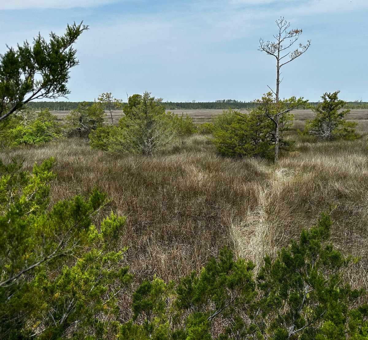
Although folks on the mainland are also worried about increased traffic, the Currituck Outer Banks is a more fragile environment that is home to a national wildlife refuge and wild mustangs. Even though the northern Outer Banks are less exposed than the southern communities on Hatteras and Ocracoke islands, the area is still vulnerable to intense tropical weather and coastal storms.
According to the North Carolina Department of Transportation, the proposed bridge is needed to provide an additional hurricane evacuation route to meet the state standards of 18 hours to evacuate an area. Once built, the bridge would offer a 40-mile shortcut to travelers, saving as much as two hours one-way during peak tourism months.
In 2022, the Currituck County Department of Travel and Tourism estimated that 500,000 travelers visited the county during the 10-week peak summer travel season each year. It would be a good bet that nearly all are heading to the Outer Banks, where they’ll end up on N.C. Highway 12 — also called Duck Road along this stretch — and likely stuck in gridlock.
NCDOT data shows the average summer weekend traffic in 2017 on two-lane N.C. 12 in Southern Shores was 22,236 vehicles. More recent DOT traffic counts were not readily available.
The proposed project includes a 4.66-mile-long bridge across Currituck Sound and a 1.5-mile-long bridge across Maple Swamp on the mainland side in Aydlett, about 25 miles south of the Virginia state line. On the Outer Banks side, the bridge would tie-in at Corolla, a popular upscale resort community renowned for its shopping, big houses, wide beaches and charming historic village. Just to its north, 11 miles of unpaved sand roads wind through the tiny community of Carova, where the wild mustangs famously roam free.
Currituck County records show 57 applications in Carova for new single-family dwellings since January 2015.
Although Currituck County Planning Director Bill Newns said he didn’t have the exact percentage of buildout in the completely off-road beach community, there were originally thousands of large lots, but there had been no new real subdivisions.
“Pretty much, it’s all been platted out … some of that stuff goes back to the ’90s, ’80s, and before then, that were already platted out,” he told Coastal Review.
“Typically, all those roads are private,” Newns said, “The county doesn’t have control of them.”
Longtime Carova resident Jay Laughmiller, who owns a water-treatment business and is also the volunteer fire chief, said he has seen firsthand the wear and tear on the community from the thousands of summer visitors. He fears that the “already controlled chaos” would be exacerbated by the bridge.
“It would not be good for the area,” he told Coastal Review. “Yes, it would grow the economy, because it would bring more people here. But the infrastructure itself can’t handle too much more.”
In the last decade or so, Currituck County has successfully marketed tourism by featuring captivating photographs of the horses frolicking on Carova’s wide-open beaches. Consequently, wild horse tours are one of the most popular attractions for visitors. Tourists and property owners are also allowed to drive on beach corridors and the unpaved roads, which has inevitably created conflicts and hazards for both horses and people.
With Carova’s beaches becoming parking lots every summer, the county in recent years instituted a permit system to control the beach traffic.
Impacts from the crowds are seen not just in rutted roads or damaged dunes; the volume and intensity of such growth is overwhelming the environmental balance.
Unlike neighboring Corolla, Carova has no stores, restaurants, public water, visitor facilities or wastewater systems. But it does have numerous single-family homes, most small and modest but with a few of 20 or more bedrooms.
Laughmiller said that septic systems and water from private wells, both subject to state regulations, are increasingly being compromised. Local rules allow placement of wells on a site to be determined after, rather than before, the house and septic, he said. Although septic must be at least 50 feet from the well, he said, leaving the well selection last can limit the quality of the well water.
“There’s no aquifers there — it’s all groundwater,” Laughmiller said.
Sometimes the water is too salty or has high levels of arsenic, iron, tannin or other unwanted stuff, or is stinky from sulfides, Laughmiller said. But current regulations, he said, look only at certain levels of bacteria before permitting a well.
Climate change effects such as rain deluges and drought, as well as increased impermeable surface coverage resulting from development, make it harder to cope with the challenges. Already, floodwater has to be pumped off the roads after big storms. Without improvements, Laughmiller said, problems with septic intrusions into well water “is only going to worsen.”
Currituck Sound is also vulnerable to climate impacts.
Julie Youngman, attorney for the nonprofit Southern Environmental Law Center, speaking at the Duck hearing, said the proposed bridge location crosses environmentally sensitive areas.
“I tell you, the ends of the bridge are going to be under water because of sea level rise before they find the money to pay for it,” she said.
The law center has represented the No Mid-Currituck Bridge group in an unsuccessful federal lawsuit challenging the bridge construction. The court ruled last year that the NCDOT had followed the law in issuing its 2019 record of decision, but the legal group is keeping its eye on the project during the permitting process.
In 2012, the project was estimated to cost $660 million, and somehow went down to $489 million in 2018, then to as low as $440 million, until soaring up to its current estimate of $1 billion.
Private-public partnerships, managed by the North Carolina Turnpike Authority, part of the state Department of Transportation that manages toll roads, have been on, then off, then on again, with unconfirmed speculation that a proposed toll would be about $50 round trip.
Youngman, who noted that her family had long vacationed on the northern Outer Banks, said that there are other less expensive and less environmentally damaging alternatives that NCDOT has not pursued, including construction of a flyway at the intersection of the U.S. Highway 158 Bypass and N.C. 12 in Southern Shores.
Logen Hodges, director of marketing and communications at the North Carolina Turnpike Authority, said the latest finance plan had not been finalized, but it is likely to include federal and state funds and toll-backed debt.
After applying for a competitive $425 million federal grant to fund some bridge costs, the agency was informed last October that it was not chosen for the award.
“The team is still evaluating all potential funding sources to deliver the project,” he responded in an email. “The toll revenue projections will be updated over the course of the next year with updated traffic and revenue forecasts. That analysis would also inform potential toll rates. Actual toll rates would not be set until much closer to the project opening.”
Comparative analysis is ongoing to evaluate whether to deliver the project as a “a traditional toll project,” or as a public-private-partnership toll project, he said.
The Albemarle Rural Planning Organization in August 2024 gave its approval to the Turnpike Authority and NCDOT to continue development of a potential private-public partnership, which was initially authorized only from 2009 to 2014.
In addition to a Coastal Area Management Act, or CAMA, permit, various other permits are required, including from the state Division of Water Resources, the U.S. Army Corps of Engineers and the Coast Guard.
“We will be in a better position to provide an updated project schedule after all environmental permits are received,” Hodges wrote. He added that all right of way parcels have not yet been purchased.
Newns, Currituck’s planning director, said the county has not yet done a detailed plan to address the projected boom in growth if the bridge is actually built. And after hearing talk about it since the 1980s, he wasn’t going to speculate on the chances of construction.
“I don’t have an idea, because every time you think you’re a little closer to it, it takes a step back,” Newns said. “So yeah, I couldn’t honestly answer that question.”