This special news feature is part of Coastal Review’s 12-month observance of the Coastal Area Management Act’s 50th year.
NEW BERN — Special Deputy Attorney General Mary Lucasse gestured to the projector screen behind her as she began her presentation to a couple dozen last month about the rules governing the last five decades of coastal development.
Supporter Spotlight
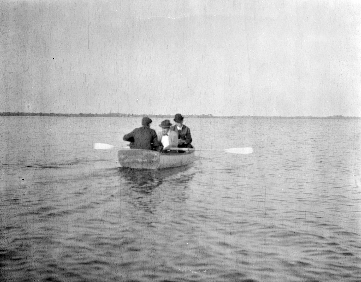
On the screen, a black-and-white photograph taken over a century ago depicting three, nattily dressed men in a rowboat, gliding across Bogue Sound with the expanse of undeveloped waterfront in the background a reminder of how much North Carolina’s coastline has changed.
When the photo was taken in 1912, the character of coastal North Carolina was “so different than it is today, 100 years later. We didn’t have bridges to the coast, people were not building on barrier islands,” Lucasse explained.
Lucasse joined the state Department of Justice in 2009, and works in the department’s Environmental Division. Her presentation, “50th Anniversary of the Coastal Area Management Act,” opened the daylong Shape of the Coast legal symposium, held in conjunction with North Carolina Sea Grant’s biennial Coastal Conference, Nov. 13-14 at the Riverfront Convention Center.
North Carolina Sea Grant, the North Carolina Department of Environmental Quality’s Office of General Counsel and the National Sea Grant Law Center partnered on the symposium that featured speakers on concerns regarding homeowner’s insurance, oceanfront homes, wetlands, sand for beach nourishment and other aspects.
“Development really started on the oceanfront after World War II, and even later than that, and what North Carolina was experiencing was a destruction of wetlands, indiscriminate development, dredging, septic tanks that were improperly sited, declining water quality,” Lucasse said. “And as the population in coastal North Carolina grew, the governor at that time realized that we lacked the public infrastructure and regulations that would allow North Carolina the capacity to handle an increase in population and development.”
Supporter Spotlight
The governor at the time, Bob Scott, worked with legislature to put together the Dredge and Fill Act in 1969. Lucasse called the measure “the start” of the state’s work to protect its coastal and the natural resources. The act put limits on dredging and filling of wetlands. Scott also directed a committee to design what would become the Coastal Area Management Act.
When North Carolina was looking to protect its coastal resources, the federal level was doing the same, resulting in the Coastal Zone Management Act of 1972, which Lucasse called “an important partner as we protect and manage the coastal resources here in North Carolina.”
CAMA was first drafted in 1973 but there was a lot of pushback from utilities, agriculture and building interests.
“At first, CAMA was opposed by 90% of the coastal legislators,” which she said was in part because coastal stakeholders wanted a larger role in the process. Legislators in response reworked the proposed act to include their feedback.
CAMA was enacted in 1974 and created the Coastal Resources Commission.
The commission adopts rules, establishes procedures for processing and enforcing major and minor development permits, considers variances from coastal development rules and appeals of permitting decisions, and other development rules.
Lucasse has been legal counsel to the commission since 2011, In that role, Lucasse advises members on open meeting laws, meeting procedures, handles public records requests, writes the commission’s final decisions, represent the commission on any litigation, and works with the North Carolina Department of Environmental Quality’s Division of Coastal Management. Division staff implement commission rules and issues CAMA permits.
“When I talk about CAMA, I always talk about the fact that this is a balancing statute. This is not about, ‘Let’s do everything we can to only protect natural resources.’ No, we balance the rights of development, the rights of property owners, with the need to protect natural resources,” she said.
CAMA protects the rights of neighbors, the public trust, the right to use ocean beaches, and to use navigable waters, she added.
A large part of CAMA is its land-use planning component. At the local level, the plans provide a blueprint for community growth and are used to guide development. At the state level, the plans review development requests and determine consistency both with state guidelines and federal regulations.
CAMA also gives the Coastal Resources Commission the power to determine areas of environmental concern. In the 1970s, the commission was directed to establish AECs.
They decided that all the barrier islands would fall under that designation, and there was “a lot of pushback for that,” Lucasse said. “They realized that really, the rules of the commission had to focus on critical areas. They began thinking about buffers, ocean beaches, not upland areas, but areas that are critical for protecting the North Carolina coastal resources.”
Now, areas environmental concern include estuarine system areas, ocean hazard areas, public water supplies, and natural and cultural resource areas. Examples are estuarine waters, coastal wetlands, beaches, frontal dunes, inlets and surface water and water supplies.

Another major aspect of CAMA is permitting and enforcement.
“I think of permits as the teeth of CAMA,” Lucasse said, because before any development in an any of the CAMA-designated areas, a permit is required, in addition to any required at the local or federal level.
CAMA grew to include in 1981 the Public Beach and Coastal Waterfront Access Program, a way to allow everyone to enjoy the shoreline.
“North Carolina realized that it was very important not only to protect the natural resources, but to allow the public to exercise their public trust rights. And this program was created to identify, to acquire, to improve and to maintain public access ways to public trust resources,” she said, noting that the legislature provided about $2 million in first-year funding.
In the decades since, appropriations have been at just over $1 million a year, she said. “Historically, the requests for funding have exceeded the amount of funding available. But since 1981, the division of coastal management has awarded over 500 grants that total about $45 million.”
Starting in 1982, the state began adding to CAMA reserve sites. Now, there are 10 coastal reserve sites making up the North Carolina Coastal Reserve and National Estuarine Research Reserve that protects about 44,000 acres along the coast.
“The reserves are really important component,” Lucasse said, adding that the sites allow for stewardship of these natural resources, research and education. Students visit the reserve sites to experience the natural resources.
Lucasse, in her presentation, was joined by Zach Griffith, a second-year law student at the University of North Carolina School of Law.
Griffith said that CAMA had undergone significant changes since 1994, including the exemption of floating structures associated with the shellfish industry from regulation, how lobbyists changed how the state interpreted sea level rise policy, the repeal of a ban on terminal groins to now allowing seven terminal groin permits that can potentially be issued.


