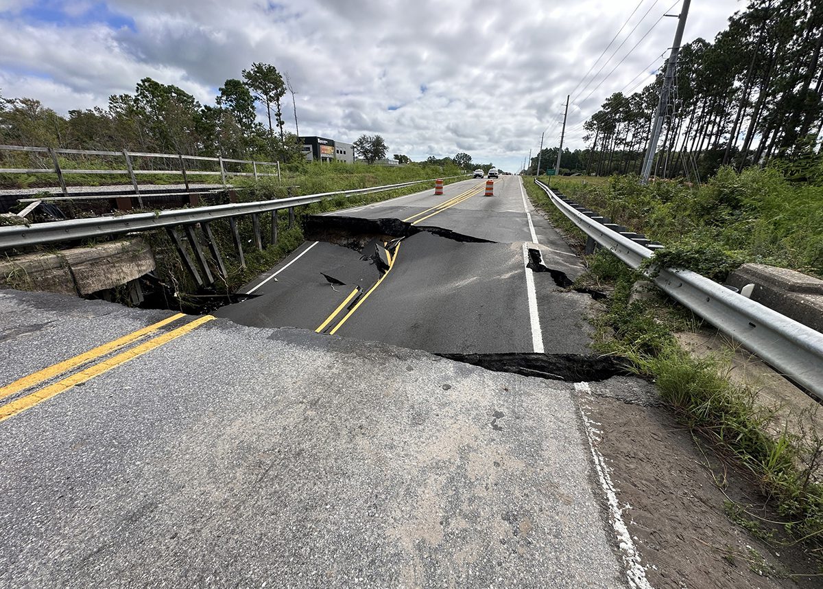
While potential tropical cyclone No. 8 was moving across the Carolinas Tuesday, parts of central and southeastern North Carolina were dealing with the aftermath — historic rainfall, road washouts and flash flooding.
National Weather Service forecasters began tracking the low-pressure system off the coast of the Carolinas late last week.
Supporter Spotlight
The center of the low pressure was onshore near Myrtle Beach, South Carolina, by the 5 p.m. Monday update and did not develop into a subtropical or tropical storm as forecasters had said was possible. As of 1:40 p.m. Tuesday, the remnants of the low were “well inland over” South Carolina, forecasters said.
Several inches of rain associated with the low-pressure system dumped on coastal North Carolina Sunday and Monday.
“Brunswick and southern New Hanover counties measured 12 to 20 inches, largely confirming radar estimates,” forecasters said, adding much of that fell within a 12-hour period Monday.
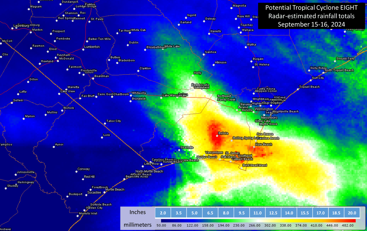
“This storm brought historic rainfall totals and flash flooding to portions of New Hanover and Brunswick counties in Southeastern North Carolina. Climatological analyses preliminarily indicate local rainfall of this magnitude is expected to occur at a point, on average, once every 200 to 1000 years,” National Weather Service’s Wilmington office meteorologists said in an email Tuesday morning.
Southport and Carolina Beach were among the towns that experienced more than 15 inches of rainfall. Each had closer to 20 inches.
Supporter Spotlight
Carolina Beach Town Manager Bruce Oakley told Coastal Review Tuesday afternoon that it had been a “crazy” 24 hours.
“We rescued 115 people and 14 animals from homes and cars since yesterday morning, Things are improving, but we are still pumping water from our lake and other areas,” Oakley said. “There are also still a few roads under water including a section of the main thoroughfare through town. We did our initial damage assessment today and expect damages to residential, commercial, and public property to be well over a million dollars.”
Southport Public Information Officer ChyAnn Ketchum told Coastal review Tuesday afternoon that residents and visitors are urged not to leave their houses unless absolutely necessary.
The only way into and out of Southport as of this report was N.C. Highway 87. Officials fully closed N.C. Highway 211 and Moore Street because of collapsed road or bridges.
“There is still quite a bit of standing water around the city and in people’s yards, with many people experiencing flooding in their yards and homes. We are encouraging all residents, businesses, and property owners to document any damage with photos and videos and to measure water levels,” she said. “The devastation in Southport and Brunswick County is devastating, but Southport is resilient.”
Bald Head Island officials said Tuesday that several of the island’s main roads were unpassable, and they advised against traveling. The ferry that is the only link between the island and mainland had suspended operation.
Brunswick County and its towns and townships, Boiling Springs Lakes, Oak Island, Southport, Saint James, Sandy Creek, Bolivia, Bald Head Island and Varnamtown were under a state of emergency.
Brunswick County Communications Director Meagan Kascsak said late Tuesday that the total number of damages is still being assessed as the response is ongoing and some damaged roads may still be under water.
“We will be able to make greater assessment of damages to structures when the period of threat is over and as we transition to recovery efforts,” she said.
Farther north, the National Weather Service Newport/Morehead City office forecasters reported rainfall in its coverage area as ranging between 1 and almost 8 inches over the past 48 hours. This office serves the area from the North Carolina-Virginia border to where Onslow and Pender counties meet.
Parts of Carteret and Onslow counties saw the highest rainfall amounts, with volunteers in Beaufort and Morehead City recording around 7.5 inches during that time, Atlantic Beach around 6.63 inches, and Jacksonville recording 5 to 7.88 inches. Counties in the northeastern part of the state saw no rain or only up to 4 inches.
The low-pressure coincided with one of this year’s king tides Sept. 15-23, which are the highest high and lowest low tide events of the year.
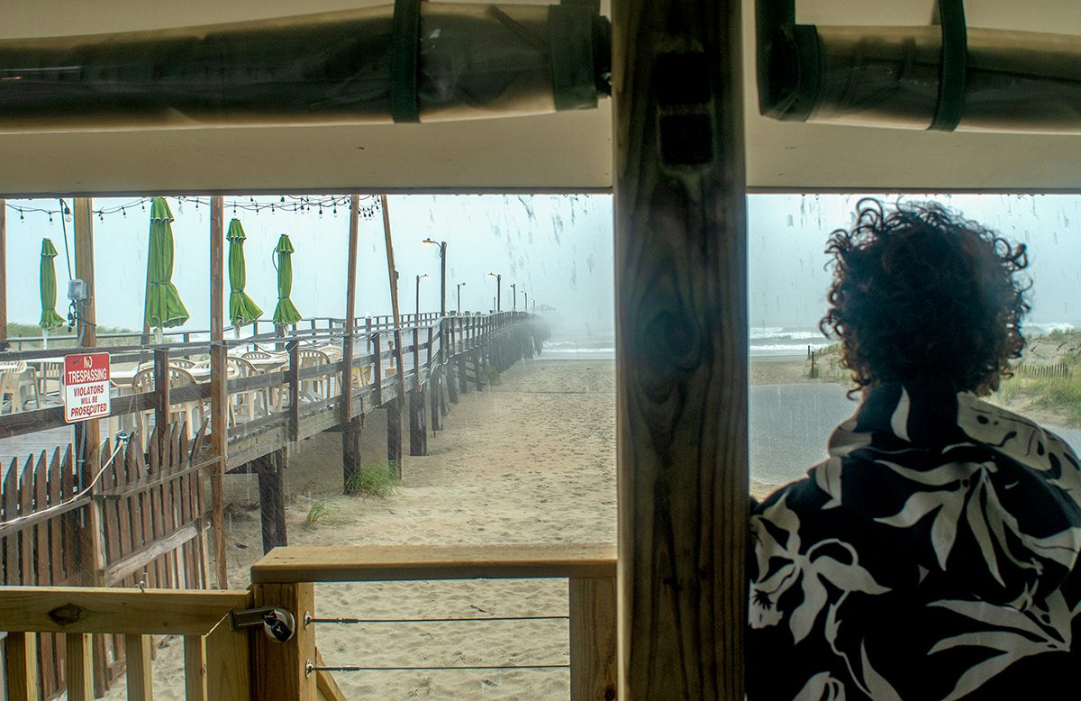
Storm response
State emergency response, highway patrol and transportation officials were still responding to closures and reports of damage in the southeast, the governor’s office announced Tuesday afternoon.
“Yesterday’s weather system reinforces why we prepare for the worst impacts of a storm and do not focus on the category or whether it is a named system,” Gov. Roy Cooper said in a statement. “As we move into today, please be safe as there are many roadways impacted and unsafe conditions persisting around the state. Check on your neighbors, do not drive through flooded areas and do not let your guard down, as additional rainfall is expected through the afternoon.”
The storm compromised infrastructure, washing out roads and damaging culverts. Though the road closures were changing constantly, throughout the day Tuesday there were between 45 and 50 closures in the state.
More than two dozen closures were just in Highway Division 3, which covers Sampson, Duplin, Brunswick, New Hanover, Onslow, and Pender counties.
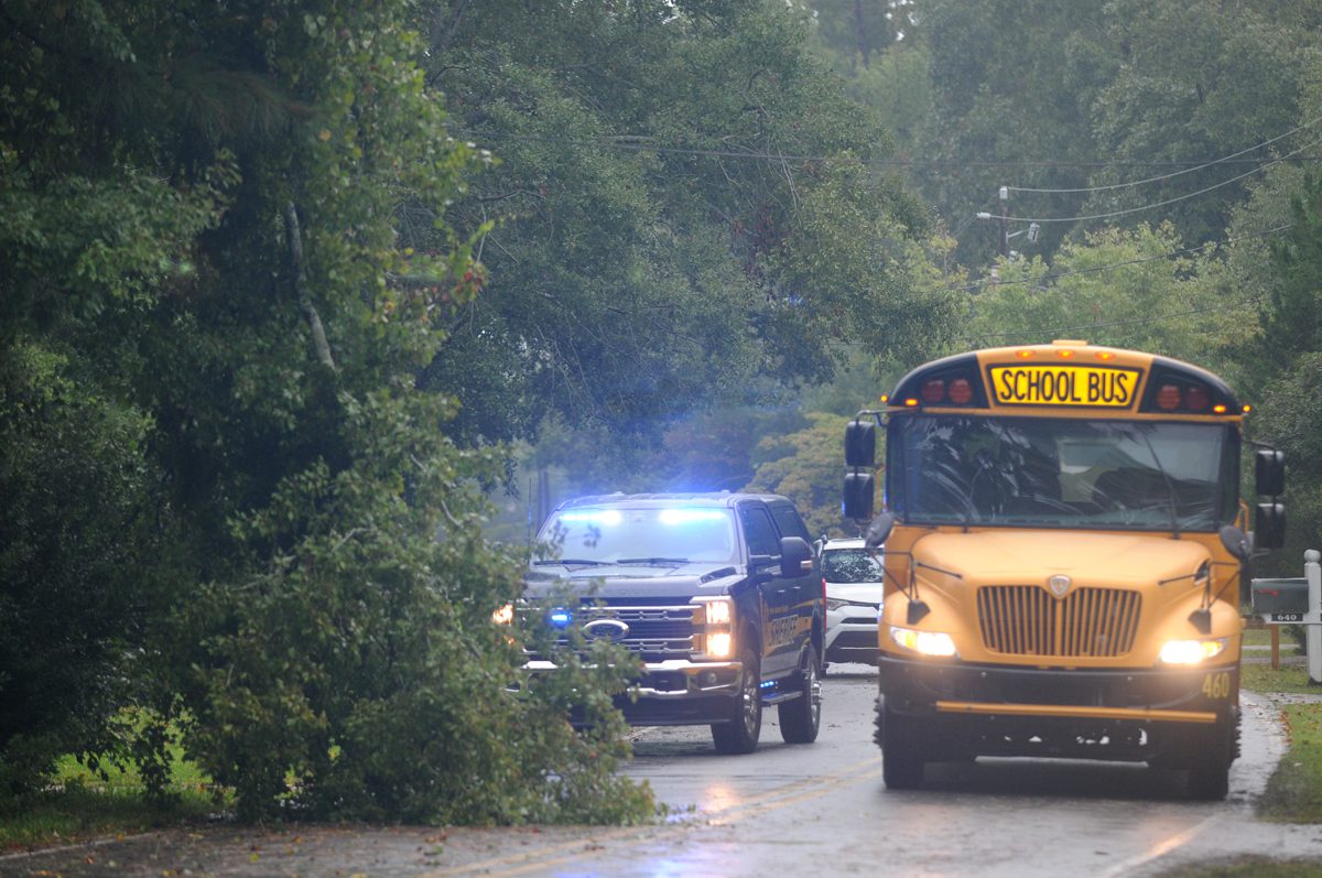
“Do not drive through standing or moving water. It does not take much water to cause a vehicle to lose control or float,” Cooper’s office said.
Visit DriveNC.Gov for the latest roadway conditions.
“North Carolina Emergency Management is continuing to support the impacted communities across our state, especially in Brunswick and New Hanover Counties, to ensure that any needs are met. A part of this support will include an assessment of damages when safe to do so that will help to inform recovery efforts as quickly as possible,” Emergency Management Director Will Ray said in the release.
North Carolina Department of Transportation Communications Officer Lauren Haviland said Tuesday that NCDOT was assessing roads to determine the repairs needed.
“While the weather has improved, the N.C. Department of Transportation continues to urge people to stay at home for their safety and the safety of others, including emergency responders. The Department is working as quickly as possible to assess the damage and repair roads,” Haviland said.
Division 1 Communications Officer Tim Hass said Tuesday the only closure in the region that includes the Outer Banks was N.C. Highway 12 at the north end of Ocracoke Island. That area was closed Monday night due to ocean overwash, but the road is expected to be reopened by noon Wednesday, according to NCDOT.
“Other than that, we’ve had some sand and water on N.C. 12 in places, but no other closures,” he said.
Post-storm advisories
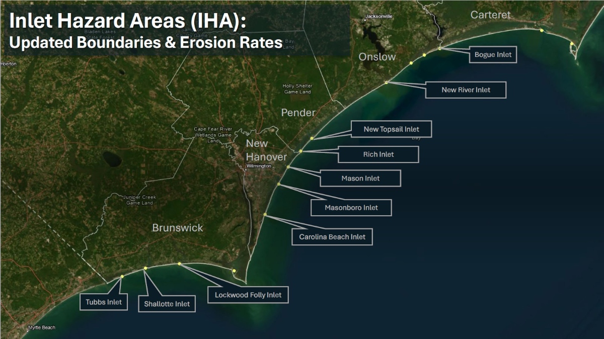
State recreational water quality officials on Monday advised that the public avoid swimming coastal waters from Mason Inlet down to Shallotte Inlet, to include Holden Beach, Long Beach, Oak Island, Caswell Beach, Bald Head Island, Kure Beach, Carolina Beach and Wrightsville Beach that are being heavily impacted by Tropical Cyclone 8.
State recreational water quality officials advise avoiding the floodwaters being pumped to waters at two oceanfront towns to minimize the flooding damage and to ensure roads are accessible for emergency vehicles.
Emerald Isle began Monday pumping floodwater into the ocean at Doe Drive, and on Tuesday at Fawn Drive, Seventh Street and 15th Street, and into the sound at Channel Drive. Oak Island has pumped floodwater into the ocean near Crowell Street.
Town officials will place signs at the discharge site along the ocean beach to warn the public of the possible health risk and will remove the signs 24 hours after the pumping stops. State officials will notify the public after the signs are removed.
Water consumers of Brunswick County Public Utilities in St. James on Cedar Crest Drive, Oak Bluff Circle, Glenscape Lane, Pinecrest Drive and Pine Bluff Circle advised to boil all water or use bottled water for drinking, making ice, brushing teeth, washing dishes, and food preparation until further notice. Periods of low water pressure and outages caused by a water main break, which can increase the potential for back-siphonage and introduction of bacteria into the water system.

