In the weeks before this year’s hurricane season began, weather and safety officials worked to spread the same message: Because it only takes one storm to impact a community, prepare now.
The National Oceanic and Atmospheric Administration’s National Hurricane Center Director Dr. Michael Brennan said Friday that “we’re on the precipice of what looks to be a very active 2024 hurricane season,” which began Saturday and ends Nov. 30.
Supporter Spotlight
This is the most active seasonal forecast that NOAA has ever issued in May, with the forecast looking to be busy with 17 to 25 named storms and eight to 13 hurricanes, of which four to seven are expected to become major hurricanes, Brennan said during a press conference at the Miami, Florida-based center.
There’s a “very high chance of a very active hurricane season,” but the main message “is preparation has to be the same every year, regardless of what any seasonal forecast says. It only takes one storm affecting you and your community to make it a busy hurricane season,” Brennan continued.
Brian Haines with the North Carolina Department of Public Safety told Coastal Review that while the Climate Prediction Center calls for an 85% chance of an above normal season, “history has taught us that it only takes one storm to impact our state, which is why we encourage all North Carolinians to be resilient and prepare for any natural or manmade disaster.”
National Weather Service Warning Coordination Meteorologist Erik Heden with the Newport/Morehead City office shared a similar message. “It takes just one storm to make an impact on our life,” Heden said.
Assistant State Climatologist Corey Davis, speaking during a recent webinar about this year’s hurricane season forecast, said much the same.
Supporter Spotlight
“An active hurricane season does not necessarily mean it’ll be an impactful one locally, but by the same token, it only takes one storm in your area to make it a very impactful and a very memorable season,” Davis said.
Tropical storms, hurricanes threats
Heden said Friday to “never, ever focus on just the category of the storm,” referring to the Saffir-Simpson Scale that measures only hurricane wind speeds, which determine a storm’s category, 1-5.
“The category tells us only the strength of the storm based on wind alone. It says nothing about how much rain we will see, what the storm surge will be, how long the storm will sit over us, whether or not it is a large or slow-moving storm,” Heden said. Adding, that Irene in 2011 and Florence in 2018 were Category 1 storms. “The category of the storm is part of the puzzle, not the whole puzzle.”
Brennan emphasized Friday during the press conference that it doesn’t take a major hurricane making landfall for there to be major impacts.
“Rainfall flooding has been the deadliest hazard in tropical storms and hurricanes in the United States over the last 10 years. It’s been responsible for more than half of the fatalities. The rainfall flooding is almost entirely unrelated to the strength of a storm,” Brennan said.
“It doesn’t matter what category it is, whether it’s a tropical depression, tropical storm or hurricane, all that matters is how long it rains and how hard it rains in a given location for a given amount of time, and again, that rainfall flooding has been the biggest killer,” Brennan added.
It’s water hazards in general have officials most concerned.
“The combination of rainfall flooding storm surge and surf and rip currents are responsible for about 85 to 90% of the fatalities we see in tropical storms and hurricanes across the United States,” Brennan said.
He called surf and rip currents “an underappreciated hazard” in tropical storms and hurricanes. These have killed more people than storm surge over the last 10 years in the United States, especially along East Coast-facing beaches like Florida, North Carolina and New Jersey. “They’re susceptible to dangerous ocean conditions that are spawned by hurricanes that might be hundreds of miles away.”
Post-storm safety is another increasing point of emphasis, Brennan said.
“We’ve lost almost as many people after tropical storms and hurricanes in this country in the last 10 years as we’ve lost from the direct forces of the storm itself,” he said. Indirect fatalities are those occurring from accidents, power issues, cardiac arrest, improper generator use, heat exhaustion and lack of medical access that are connected to storms.
To help communicate the hazards associated with hurricanes and storms, Brennan said that the National Hurricane Center is disseminating Spanish language products translated by artificial intelligence programs to reach those whose primary language is Spanish.
“The other thing we’re doing is rolling out an experimental version of the cone graphic by mid-August that’s going to show the inland extent of the tropical storm and hurricane watches and warnings,” Brennan said.
How, why preparing is critical
Knowing your risk is the first step to prepare for a hurricane, Brennan said Friday.
“Know if you live in a storm surge evacuation zone — that forms the foundation of your entire hurricane preparedness plan,” Brennan said. You may be asked to evacuate your home by emergency management or government officials and “you need to know where you’re going to go, how you’re going to get there, what you’re taking with you.”
And remember that in many cases, you only need to evacuate tens of miles, not hundreds of miles, to get to a safe place.
“Preparation is key. If you’re going to shelter in place for a storm, you want to have your emergency kit in place,” Brennan said, and you should start collecting now multiple days’ worth of nonperishable food, water, medicine, batteries — “anything you’re going to need to survive the aftermath of a major hurricane landfall” — taking into account that there may be power outages for days, with no access to medical or emergency services.
Federal Emergency Management Agency Deputy Administrator Erik A. Hooks said Friday during the press conference that officials were “getting down to the wire” when it comes to making sure communities are prepared.
“The time to make sure that you have a clear understanding of your unique risk is now,” said Hooks.
Things you should prepare for and take into account to be risk ready include the following:
- Do you have medication that requires refrigeration?
- Do you have a medical device that runs off electricity?
- Do you have mobility challenges that make it more difficult to evacuate in a time?
- When was the last insurance checkup, including flood insurance?
“Now is the time to ask yourselves these questions, understand your particular risk for you and your community, and put a plan together so that you are prepared when disaster strikes,” Hooks said. “Start getting risk-ready now.”
Heden said that while peak hurricane season isn’t until Sept. 10, eastern North Carolina has had storms in June and July.
“You should prepare each and every year for hurricane season, and please don’t wait,” Heden said. Preparedness is a three-step process, he said.
The first step is to know your risk, and “Vulnerability extends beyond weather risk,” Heden said. “Who lives in your home? Do you have young kids, elderly parents? Does somebody in your home rely on power for oxygen? Your vulnerability will help you determine the next two steps.”
The second step is to have a hurricane kit with at least three to seven days’ worth of food, water and medicine.
If you choose to stay during a storm, you may not be able to get out or first responders may not be able reach you.
“Life won’t be normal right away,” and you may be without help for at least three days, or longer, Heden said, also suggesting purchasing items here and there to buffer the financial strain of preparing.
And the third step is to have an evacuation plan with at least two places to go, Heden explained.
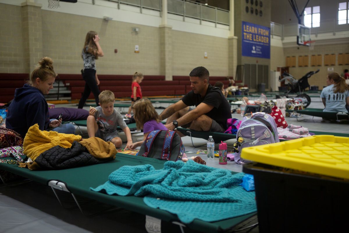
“I like to have a northern and southern option. You want to go away from the storm’s path. Don’t just plan to go to Goldsboro or Raleigh. Sometimes impacts occur well inland,” he said. “Make sure your plan includes your pets and anybody in your house. Your last resort is a shelter. Those are stressful and packed. You will be more comfortable in a hotel or a family or friend’s house.”
Haines said to ensure multiple ways to receive information from reputable sources, such as area emergency management team and public safety agencies, local media outlets, or North Carolina Emergency Management.
Everyone living or vacationing in North Carolina’s coastal counties should also Know Your Zone. That’s the name of an initiative that established evacuation zones to streamline the evacuation process in the event of an emergency, Haines said.
From an insurance perspective, State Department of Insurance Commissioner Mike Causey said Wednesday during a press conference in Kinston livestreamed by Neuse News that preparation should include steps to protect important documents like car titles and deeds. Causey also recommended speaking with an insurance agent in advance of a storm, “and if you don’t have flood insurance, look at getting a flood policy, because you have to have a separate flood insurance policy to have that covered.”
Causey cautioned that companies won’t issue insurance when there’s a named storm heading in this direction.
“You’re not going to be able to buy insurance, and when you do buy flood insurance, there’s a 30-day waiting period, so you’ve got to think at least more than 30 days ahead to get that flood insurance coverage,” he said.
People really need to understand and know that homeowners policies do not cover floods, Causey explained. “We learned that lesson — hard lesson — during Hurricane Florence, when we had 23 southeastern counties underwater, and 88,000 people lost their homes and everything in it and found out they had no insurance because floods are not covered under a homeowner’s policy.”
He said the department is there to help and residents can call to speak to a representative or email with questions, disputes or claims. Contact information is on the department’s website.
Why an above-normal forecast?
“Human-caused climate change is warming our ocean globally and in the Atlantic basin, and melting ice on land, leading to sea level rise, which increases the risk of storm surge. Sea level rise represents a clear human influence on the damage potential from a given hurricane,” NOAA officials said when it released the May outlook.
NOAA Administrator Dr. Rick Spinrad, speaking during a press conference May 23, said that this season is looking to be extraordinary in a number of ways. Data and models show El Niño/La Niña weather patterns playing a significant role.
El Niño is the flow of warm ocean surface waters from the Pacific toward and along the western coast of South America. La Niña is the opposite: an upwelling of cold Pacific Ocean water to the surface along the western coast of South America.
“The key this year, as in any year, is to get prepared and stay prepared,” Spinrad said. “It’s the best way to reduce risk, especially the risk of potential loss of life.”
The Climate Prediction Center in May forecast a 77% chance of La Niña forming during the August-October time frame and “We know the development of La Nina can lead to weaker easterly tradewinds and below average vertical wind shear in the tropical Atlantic Ocean.” Such conditions can be more conducive for tropical cyclone development.
Additionally, Spinrad said, NOAA’s National Center for Environmental Information has reported record warm water temperatures for much of the tropical Atlantic Ocean.
“Forecast modeling indicates that above-average sea surface temperatures are predicted during the peak months of the Atlantic hurricane season from August to October,” Spinrad said. “We know warm sea surface temperatures are an important factor in rapid intensification of tropical cyclones to major hurricane status.”
NOAA’s outlook is for overall seasonal activity and is not a landfall forecast. NOAA’s Climate Prediction Center will update the 2024 Atlantic seasonal outlook in early August before mid-September, the historical peak of the season, officials said.
Visit ReadyNC.gov for more information from the state on preparing for storms or knowyourzone.nc.gov to learn more about the coastal evacuation zones.


