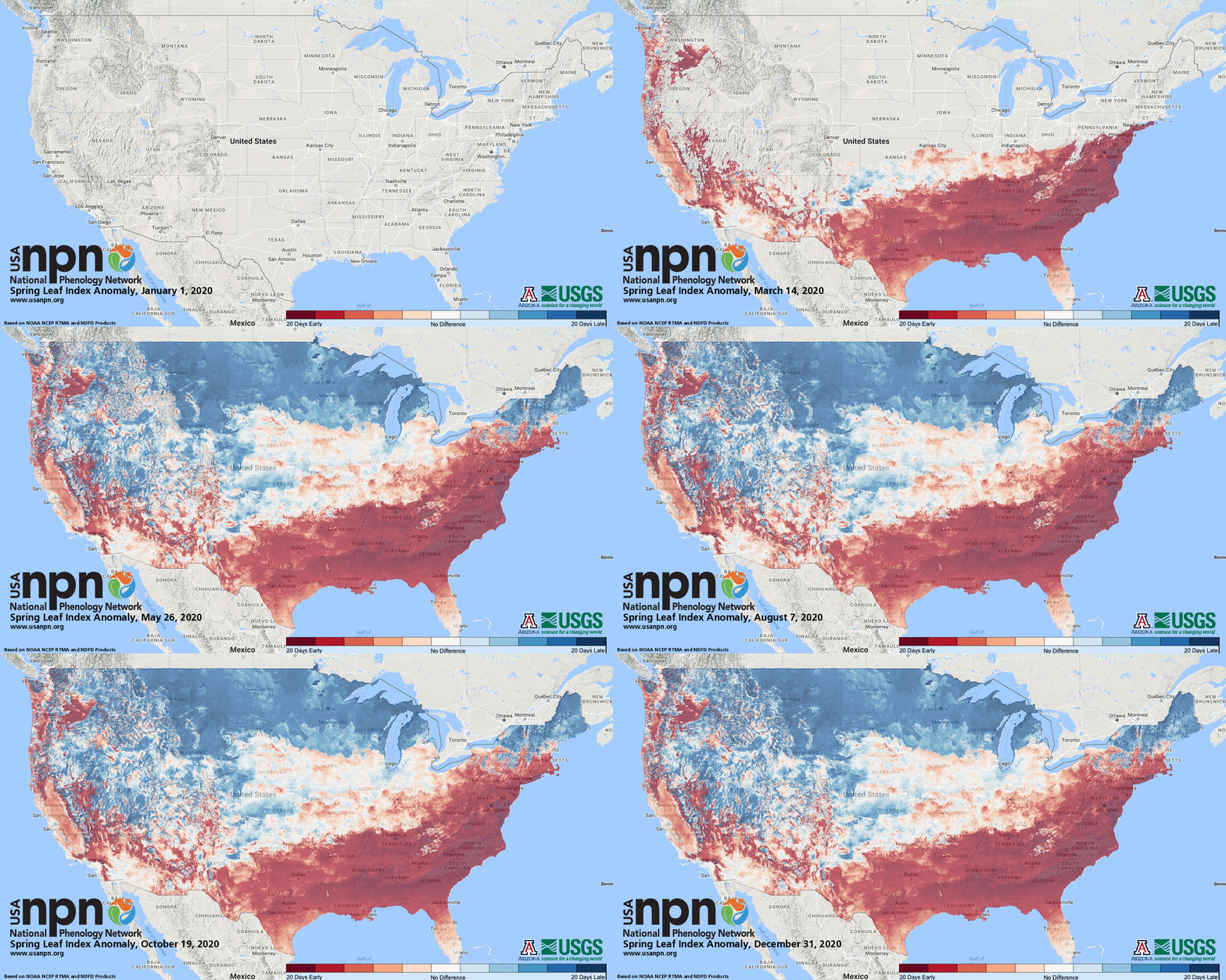
A rodent in Pennsylvania recently predicted an early spring, and science appears to support Punxsutawney Phil’s latest forecast.
Along much of the North Carolina coast and in other parts of the Southeast, signs of spring may be appearing this year earlier than the long-term average, or climate normal. Here in eastern North Carolina, spring is arriving about two to three weeks earlier, and in some parts of the state almost four weeks earlier than the long-term average.
Supporter Spotlight

“Buds are starting to break at this time, almost a month ahead of schedule in some locations,” Theresa Crimmins, assistant director of the USA National Phenology Network, or USA-NPN, in Tucson, Arizona, told Coastal Review Online Monday.
Phenology studies the timing of seasonal plant and animal life cycles, such as when plants flower, fruits ripen, migratory birds begin their flights and insects hatch.
USA-NPN was established in 2007 with funding from a five-year National Science Foundation grant. The U.S. Geological Survey and the University of Arizona set up a national office that coordinates with scientists, agencies, educators and others to share phenological data.
Using mathematical models that incorporate historical climate data from between 1981 and 2010 — a baseline used as the climate normal or long-term average – along with a network of lilac and dogwood trackers and real-time National Weather Service temperature analysis, USA-NPN creates “synthetic measures” of changes to track the appearance of the first leaves on early spring shrubs and other plants across the country.
“We use that period (1981 to 2010) because it’s the climate normal period, which is always a rolling window of the most recent, complete three decades,” Crimmins said, adding that the window will shift next year to 1991 to 2020.
Supporter Spotlight
The resulting measures of spring’s onset are the First Leaf Index, which is the “leaf out” of lilacs and honeysuckles, and the First Bloom Index, which is based on when those two plants begin to flower.
By this measure, how early is spring in coastal North Carolina?
“It looks like anywhere from 11 to 12 days up to 24 to 28 days,” Crimmins said.
Lilacs don’t grow on the North Carolina coast but there are other indicators.

“We do have honeysuckle, but I’m not sure if it’s leafed out,” said Shawn Banks, director of the Morehead City-based Carteret County Cooperative Extension. “This is the earliest I’ve seen the Bradford pears blooming and the loropetalums. A lot of things are blooming with the warm weather we’ve had the past week and a half.”
January here was also warm. Despite reports of snow flurries Jan. 20 on the Outer Banks, some of the coldest air of the season, the average temperatures last month were 6 to nearly 8 degrees warmer than normal on the coast, according to a monthly climate review prepared by the National Weather Service’s Newport/Morehead City office.
Hatteras saw an average high of 60.1 degrees, compared to a normal high of 52.2, and Plymouth saw an average high of 61.1 degrees, compared to a normal high of 53.2. Beaufort averaged 7.2 degrees warmer than the normal of 53.3.
Average low temperatures were also well above normal. Williamston’s average low of 38.6 was 8.3 degrees warmer than normal and Bayboro’s average low of 40.8 was 7.9 degrees warmer than normal.
Extremely warm days were measured in New Bern on Jan. 3 when it reached 82 degrees and Bayboro Jan. 4 when it hit 79.
Though it takes more than a warm day or two here and there, the accumulation of early season warmth is a major factor in how early plants leaf out and is used in the USA-NPN’s predictions.
“In most of the temperate parts of the country, what activates plant activity in the spring is the presence of warmth,” Crimmins said. “One of the ways that’s represented mathematically is the daily average temperatures starting Jan. 1.”
Crimmins and Michael Crimmins, a specialist in climate science and professor of environmental science and geography at the University of Arizona, published research last year that, along with the National Oceanic and Atmospheric Administration’s Climate Prediction Center, predicts plant and animal activity will be ahead of schedule in the Southeast and other parts of the country.
“Not a single warm day but a sequence of warmish temperatures for an extended period of time, it is that amount of warmth that can activate cascades of hormones in plants,” Theresa Crimmins said. “Not all plants pay attention to the same cues, but some are more excited to respond.”
Those plants that do respond are most at risk during a subsequent frost but leafing out early can give plants a leg up in terms of being the first to access nutrients in the soil and avoid being crowded out or shaded by other plants, she said.
“It’s competition among plants,” she said.
Banks, with the Carteret County Cooperative Extension, said there’s still plenty of time this winter for temperatures to plunge low enough to damage plants.
“We still have all of March when we can have really hard freezes,” he said.
That means crops that flower early could be vulnerable, including strawberries, peach trees and other fruit trees.
“It happened a few years back with grapevines, we had a really hard freeze at Easter,” Banks said. “Most farmers have system to get through the frosty days, as long as it’s above 28-29 degrees, but for most homeowners, it’s going to be a lot different. Unless they have some way to keep air circulating around the tops of their fruit trees, it can be really difficult to save a crop. Fruit trees, once they bloom, they’re going to be gone — no fruit.”
Fortunately, he said, “most plants around here have enough stored energy they can leaf back out.”
Are plants in coastal North Carolina protected by ocean temperatures from an early onset of spring? Maybe. Crimmins said the heat accumulation maps do indicate a slight buffering effect, at least in some places.
“I definitely see a thin strip along the coastline between Morehead City down to Myrtle Beach where it looks like the start of spring is not quite as early,” she said in a follow-up email response. “I am seeing the date we estimated buds to start breaking in the inland parts of the state to have occurred mid-January; along the coastline, it’s more like the very end of January (about 2 weeks later). Along the coastline, it’s still earlier than ‘normal’ (based on when buds have broken on average 1981-2010), but not as early as the inland portions of the state.”


