BRUNSWICK COUNTY — Maybe there were once many eagles on Eagles Island and perhaps people were just hungry when they named Brunswick County landmarks like Frying Pan Shoals and Corncake Inlet. The truth, though, is that names of places may not be as straightforward as they appear. They do, however, reflect the families and culture that shape who we are.
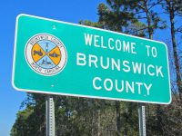 What we name the things around us does indeed reflect something about us. This is the first in an occasional series on coastal places names that take a look at those places over the next several months. Each story will feature one or two of the 20 coastal counties.
Supporter Spotlight
Let’s start with Brunswick.
Those familiar with local history might know the county’s name comes from Brunswick Town, the community started along the Cape Fear River in 1726. Founder Maurice Moore choose the name as a way to honor George I, the King of England and Duke of Brunswick. It was a familiar practice in colonial times, and the reason there are so many English and European names along the coast.
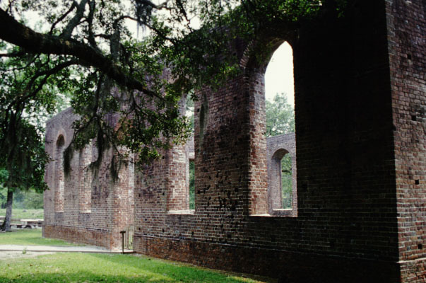
For much of its early history, though, the lands west of the Cape Fear River were a part of New Hanover County. For more than 20 years in the 1700s, those in and around Brunswick Town fought for their own regional independence – something that was finally granted in 1764, said Jim McKee, manager of the Brunswick Town/ Fort Anderson Historic Site.
So the reason Brunswick County is so named today is part an effort to please far-away monarchs and part good ‘ole American spirit.
While this story, and others, are well established, other names are replaced over time with new ones or their origins get lost and we can only guess at their meanings. “I try to listen to those ‘I heard’ or ‘I thinks,’” said Musette Steck, former president of the Southport Historical Society. “There’s usually a kernel of truth in there, a place to start looking.”
Supporter Spotlight
She and others who follow those leads can see our coastal counties in a different way, in a way where street signs and town names show the way to our local history.
I Am Street
One of the favorite origin stories in Brunswick County is how a street in Southport came to get the name I Am. It’s not always a favorite, though. Steck wishes someone would have kept to the tradition of naming the streets after notable figures in the town’s history. That was, after all, how Moore and Rhett streets got their name – as well the reason for streets Lord, Howe and Dry. Robert Howe Jr. and William Espey Lord Jr. were two of the founders of the town and William and Mary Jane Dry were among the county’s leading citizens, McKee said.
Along this set of streets, there was a two-block alley in downtown Southport that wasn’t adequately named according to the telephone company doing work in the area in the 1950s. The story goes that a town clerk decided to have a bit of fun by using the well-known ditty, “How Dry I Am.” Steck believes that the same group of townsfolk who once held a funeral service for a man’s legs are also responsible for this bit of fun. (After 18 years, she finally believes she learned where the legs are buried, she said.)
Lockwoods Folly
“It’s one of the oldest names in the area,” McKee said. This tidal river that flows from the Green Swamp first appears on a map in the 1670s. It’s now known as Lockwood, or Lockwoods or Lockwood’s. But the Folly stays. One of the most popular stories about the origin is that a Mr. Lockwood, about whom not much is known, built a boat along the banks of this river, McKee said.
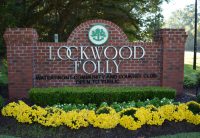
“But it couldn’t get down the river,” he said.
The whole enterprise was dubbed an act of foolishness or folly. There is some evidence that the ill-advised venture was related to a settlement that failed for some reason.
An alternate theory, according to “The North Carolina Gazetteer,” is Folly is a variation on the French term folie. Although it means “madness” today (which supports the previous theories) it could mean a delight or favorite abode in the 17th century and was therefore used in the naming of English estates.
Keziah Lake
Sam Keziah, a retired insurance agent and son of the principal of a Shallotte school, learned about one of his influential relatives soon after moving to Brunswick County as a boy. Bill Keziah was his great-uncle.

“He was a newspaper man, along with the Harpers of the State Port Pilot,” he said.
As a reporter, he was also deaf, and would interview his sources via handwritten notes.
“I think someone like that at that time, in the ’50s, would have really stood out,” Keziah said.
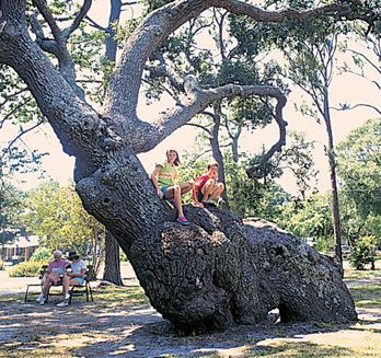
And maybe that is why there are quite a few Keziah namesakes in Brunswick County. One is Keziah Park in Southport, a four-acre parcel home to the Indian Trail Tree. “It’s said that these trees were bent to point to good hunting and fishing grounds,” he said.
Another of those is in Boiling Spring Lakes. It’s no surprise that the name of that town comes from the spring that flows through the area and is said to discharge 43 million gallons a day. According to the town, the spring was once known as Bouncing Log Spring, because of a piece of petrified wood churning in the water.
“The town is alleged to have 50 lakes there, and there’s a Fifty Lakes Drive,” Keziah said. “Most of them aren’t very big.” And some of them do have names, like Seminole or Mirror or Patricia. There’s also a Keziah Lake located to the north, close to Pretty Pond and a neighbor of Harper Lake.
Bald Head Island
This island at the mouth of the Cape Fear River is one long known to sailors. The island marks the location of the dangerous shifting sands of Frying Pan Shoals, which are named for their shape, as they jut out handle-like from the island. Perhaps this is why mariners made sure to note any relevant geographical features.
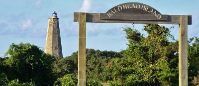
“There are a number of different accounts of ship captains referring to Bald Head Island as Barren Head,” McKee said. “The island had a big sand dune and it looked like a bald man’s head.”
The island was a part of one of the first land grants in the area, which went to the Smith family, McKee said, and became known as Smith Island, and the town that is now Southport was Smithville.
“The island started to become known as a resort area and as a place to enjoy salubrious, healing sea breezes,” he said.
The current community and resort of Bald Head reverted to a version of its earlier name. Something similar happened with Smithville, McKee said. The town was the site of a natural deep-water harbor. Deep Water Point is located near the Bald Head Island Ferry terminal. Nineteenth century residents wanted to capitalize on that economic possibility.
“Eventually, it was decided that maybe the name was the problem,” he said. “It was renamed Southport in March 1887 to see if that would get things going.”
Waccamaw
Although Lake Waccamaw is in Columbus County, the northwest corner of the Brunswick also takes this name as one of the townships, from the Waccamaw Siouan tribal nation. According to tribal history, the name Waccamaw first appeared in 1712. The Waccamaw Siouan call themselves the People of the Falling Star, for the origin story of the lake – that a meteor streaked through the night sky and waters flowed into the crater to form the lake.
Although the history of the tribal name is unclear, historians used the Catawba language for comparison and guess that it came from a game called Wap-ka-hare. Its translation means “ball knock” and it’s pronounced something like “wahumwar.” According to the tribe, it’s assumed that Waccamaw is an English version of this pronunciation.
Brick Landing
Many names in Brunswick County are derived from notable families. The Gause family were influential planters and there have been landmarks called Gause’s Hill, Gause Landing and Gause Beach. They are also indirectly responsible for this community.
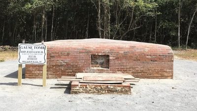
“The Gause Family had one of the nicest houses in the area,” Steck said. There’s also the Gause Tomb, with brick walls 18 inches thick. “It got its name because that’s where they unloaded the bricks.”
More modest brick tombs were more typical of the era and the elite planter class. The Gause Tomb, though, dates to the 1830s and is considered a show of wealth. The cambered brick-paved roof, supported on the interior by vaulting and a central brick pier, is similar to the brickwork at Fort Caswell, and historians speculate that there may be a connection.
Fort Caswell
One of Keziah’s favorite namesakes in Brunswick County is Richard Caswell. He was an
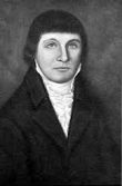
accomplished resident of the state, he said. Caswell was born in Maryland in 1729, but moved to Kinston, where he is buried, to work as a surveyor before pursuing a career in law. He represented North Carolina at the first Continental Congress and eventually became the state’s first governor in 1777. He served another term in 1785.
The fort dates to 1825 and was built because the area was vulnerable, according the site’s history. The construction of the fort, built of stone and earthworks, was considered one of the strongest in the world and most of it remains today. There is also a nearby Caswell Beach in the Brunswick County and a Caswell County in the northern part of the state.


