RALEIGH — Bills that would make it easier to armor the state’s beaches with sandbag walls and would weaken rules meant to protect the Neuse and Tar-Pamlico rivers by taking the “wet” out of wetlands are among the coastal bills state legislators will consider this week after returning from their first-ever “spring break.”
Also awaiting action in N.C. General Assembly are measures that would investigate swapping land for a portion of a national park, strengthen the state’s oyster industry and study water use in the Cape Fear River basin.
Supporter Spotlight
Like past sessions, some of the proposals will likely be enacted through large, omnibus bills. Others could end up in the state budget, which should start emerging soon as April tax revenues become clearer. That money is an especially key indicator this year because of the changes to the tax code that the legislature made last session.
Legislators are facing an April 30 “crossover” deadline. After that date, any non-budget related bills not passed by one chamber can’t be taken up again.
Sand Bags as Seawalls

Among the many provisions in this year’s version of a Senate regulatory “reform” bill are changes to rules about temporary sand bags to control erosion along the state’s beaches. Critics fear they would lead to widespread use of the giant sand bags that once in place are hard to remove.
The provision requires the state’s Coastal Resources Commission, or CRC, to rewrite its rules for sand bags — the legal parlance is “temporary erosion structures” — that would allow the owner of any property adjacent to an existing sand-bag wall build one on their property without first proving that the building is imminently threatened by erosion, as the current rules require.
The proposal also eliminates a distance requirement on how far away from a structure a wall can be built. Right now, the rules say the walls cannot extend more than 20 feet beyond the protected structure.
Supporter Spotlight
Mary Maclean Asbill, an attorney with the Southern Environmental Law Center, said the changes are significant because they move away from using sand bags just to protect homes that are immediately threatened by erosion. With the changes, she said, the potential is great for longer lines of walls much closer to the water.
“This would eliminate the requirement on where you can build a wall,” she said. “You can envision sand-bag wall after sand-bag wall down the beach.”
Todd Miller, the executive director of the N.C. Coastal Federation, fears that the new rules could end up restricting the public’s access to the beach. “Temporary,” he said is just a word in the regulations. In practice, once they’re built, the walls rarely come down, though current rules say the walls can remain for no more than five years for the largest structures, explained Miller.
“This could easily result in a more and more beach being degraded by long lines of sand bags that will function like seawalls,” he said. “In places where erosion persists, sand bags become de-facto seawalls,”
Under the bill, the CRC would be required to adopt temporary rules on sand bags by the end of the year.
Taking the ‘Wet’ Out of Wetlands

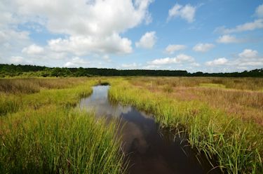
Sen. Bill Cook, R-Beaufort, introduced a bill early in the session that would change existing rules by reducing or even eliminating the buffer requirements in any protective sense for the Neuse and Tar-Pamlico river basins. The bill would not allow wetlands and marshes to be included as surface water and would instead count them as dry lands when determining the buffer.
Similar language is included in the House’s regulatory “reform bill that was introduced yesterday. Rep. Chris Millis, R-Pender, is one of the primary co-sponsors.
As the name implies, “wetlands” are by definition “wet.” The U.S. EPA defines wetlands as “lands where saturation with water is the dominant factor determining the nature of soil development and the types of plant and animal communities living in the soil and on its surface.”
By pretending that wetlands aren’t wet, though, the proposed bills would in practice greatly reduce the size of the protective buffers along the Neuse and Tar-Pamlico rivers or even do away with them entirely. Under current rules, most new construction in the river basins must be 50 feet from the water. Wetlands are now considered part of the water. With the stroke of a pen, however, the bills would turn them into dry land, allowing the buffer to extend into the wetlands that are by legislative fiat no longer wet. If a property is fronted by more than 50 feet of these dryland wetlands, then, the entire buffer would be in water that isn’t water.
In an interview in March, Cook said the change isn’t being driven by any specific project but reflects long-running complaints with the buffer rules. “We’re trying to add some common sense to that,” he said, adding that had heard complaints of “overzealous regulators” using the rules to add burdensome requirements to projects.

“Some of the things they are asking just flies in the face of common sense,” he said.
Cook didn’t provide any specific examples.
The state’s Environmental Management Commission passed the buffer rules in the late 1990s to try and stem the flow of nutrients and pollutants in stormwater runoff that were fouling the rivers. Harrison Marks, director of Sound Rivers, said he was disappointed that the bill would weaken the buffer requirements. The two river systems, he said, need more protection.
“The buffer rules have been in place for more than a decade and the scientific community is clear that the buffers are effective at protecting the quality of our drinking water and coastal fisheries,” he said.
If the bills pass, this could all run afoul of the feds. The rivers have long been listed as “impaired” under the federal Clean Water Act because of polluted stormwater runoff. The buffers are part of a management plan approved by EPA to improve water quality in the rivers. Environmental groups are likely to challenge changes that redefine “wetlands” and reduce the effectiveness of the buffers.
The change could affect cities and towns in the basins that discharge treated sewage into the rivers. EPA could require them to upgrade their treatment plants to remove more nutrients from the discharges if the agency determines that the riparian buffers are no longer as effective as the management plan envisioned.
Boosting Oyster Industry
Companion bills in the House and Senate are aimed at bolstering the state’s oyster industry. Both bills call for a study of the permitting system, increasing fines for violations, establishing an oyster sanctuary program for Albemarle and Pamlico sounds and instructing DENR to work with federal officials and the commercial fishing industry the develop a proposal for opening up areas of Core Sound for shellfish cultivation.
The House version, H302, would also revive the Joint Legislative Oversight Committee on Seafood and Aquaculture, a legislative policy steering committee that was ended in 2011.
A Jetty on Shackleford?

Another key piece of coastal legislation that’s likely to move in the Senate is the latest version of Senate Bill 160, Enhance Safety and Commerce for Ports and Inlets. A rewrite of the bill was passed by the Senate appropriations committee before the break.
It includes an odd provision that would allow the N.C. Department of Administration to negotiate a land swap with the federal government for “federally owned property necessary for management of deep draft navigation channels” near the state port in Morehead City.
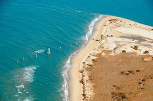
That means Shackleford Banks, which is part of Cape Lookout National Seashore, and sits astride Beaufort Inlet, the only entrance into the port. The inlet is said to be plagued by shoaling.
Asbill said she believes the language is aimed at clearing the way for a jetty, groin or some kind of hardened structure at the west end of Shackleford Banks to reduce the flow of sand into the inlet. She said given the agencies involved and the heavy use of the area by visitors, it won’t be an easy negotiation.
“This is another example of wishful thinking,” she said. “It sets up a huge fight with the National Park Service.”
The rest of the bill is as you would expect. It puts $6 million in an existing fund to dredge lakes and shallow draft inlets and sets up a new $1 million dredging fund for deeper inlets. More than half of the larger pot of money would be used to dredge shoaled up Oregon Inlet in Dare County. A portion of the other fund is earmarked for work at the mouth of the Cape Fear River, including removing “The Rocks,” a breakwater near Zeke’s Island built by the Army Corps of Engineers in the late 1800s.
Sen. Harry Brown, R-Onslow, who co-sponsored the bill, said at a Senate committee hearing that the state is in a tough position due to cuts in the federal budget, which used to include between $7 and $8 million annually for dredging along the N.C. coast.
“Those dollars have pretty much gone away,” he said.
The result could have a major effect on the coastal economy. “Up at Oregon Inlet you’ve got a major boat manufacturer that uses that inlet that’s ready to move out of North Carolina because they can’t get the boats out of the inlet any longer,” Brown said.
Cape Fear Water Study

A major study of water use and growth estimates for communities that rely on the Cape Fear River for their water is part of new legislation co-sponsored by Rep. Rick Catlin, R-New Hanover.
In a recent interview, Catlin, who co-chairs the House Environment Committee, said the bill is in part a reaction to a decision by the state Department of Environment and Natural Resources to allow communities in the Triangle to draw more water from Jordan Lake, which is in the upper Cape Fear.
Catlin said he wants to get a better handle on water needs and water use before another major allocation request or interbasin transfer request comes along.
“The next time we get an interbasin transfer request we need information on how sustainable it is,” he said.
He said a major fear is whether there will be enough water on hand for seasonal use downstream. He said heavy demand for groundwater during the summer season is affecting local wetlands, especially around Wrightsville Beach.
Catlin said one idea he is looking into is whether water from the Cape Fear can be drawn down during the winter and stored in local aquifers for use during peak season.


