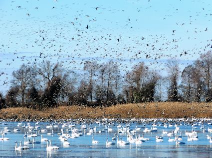
 Lake Mattamuskeet recorded a record number of ducks, geese and swans last year despite declining water quality. Photo: FWS |
SWAN QUARTER — Lake Mattamuskeet, the state’s largest natural lake, is troubled. Its good vegetation has been depleted while its bad plants are thriving. It has questionable water quality. It might or might not be too shallow, too salty and suffering impacts from climate change.
Supporter Spotlight
Everyone is worried, but no one can definitely say what’s going on in the lake because little long-term data exists.
Although the 18-mile long, 7-mile wide lake is the centerpiece of 50,000-acre Mattamuskeet National Wildlife Refuge, money over the years for studies of water flow, salinity and nutrient levels, fish stocks and historic rain and flood trends has been inconsistent or nonexistent.
Supporter Spotlight
The lake attracts thousands of wintering tundra swans, Canada geese, snow geese, pintails and mallards, as well as less common bald eagles and ospreys. Of the 800 or so species of wildlife that are found at the refuge, there are more than 200 bird species that nest there all or part of the year. The most recent survey in January recorded more than 200,000 ducks, geese and swans on the refuge, a record number, according to a refuge press release.
But the lake is also renowned for its great fishing, especially its notably huge blue crabs. Much to the chagrin of fishermen, its herring, eel and largemouth bass fisheries have diminished, and it is not known whether any one of them is recovering. The lake also has been overrun by phragmites, an invasive and opportunistic reed plaguing many wetlands in North Carolina.
To address increasing concerns about the health of the lake’s ecosystem, a meeting was held by the refuge in November to present “scientific information about the water quality, fish and bird species and management of the lake and canals. In response, a meeting was held in late January by a group of stakeholders called Save Mattamuskeet Lake.
“Prior to 2002, it was world-class bass fishing, “said Mark Carawan, a founder of the group and an owner of a motel on N.C. 94, which intersects the lake. “The birdwatchers are even complaining – you can ride across Lake Road and you don’t see (any) waterfowl.”
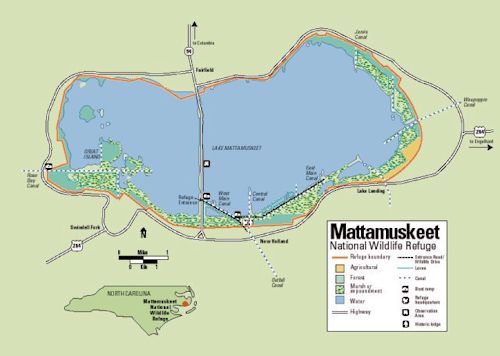 N,C, 94 bisects the lake. The eastern, larger, half has better water quality and more underwater grasses than the other half. Map: FWS |
Carawan said his tackle shop went from selling $10,000 a month of minnows from March through June 2002, to a total of $300 in those months last year.
The group contends that the refuge is mismanaging the flow of water in and out of the lake, resulting in high salinity, shallow water and poor conditions for submerged aquatic plants that are critical food for waterfowl. A big part of the problem, the group says, are the gates that allow too much brackish water in from Pamlico Sound and too much fresh water to escape.
“I want them to replace the gates where the water will stay in the lake for a certain period of time,” Carawan said, “to be kept at a level that will sustain the bass fishery.”
But Pete Campbell, the refuge manager, said that keeping the lake high would almost certainly have negative effects and could not even be considered without further study.
Numerous gates on canals between the sound and the lake open and close depending on the pressure exerted from water levels on each side. The structures are intended to keep salt water from coming into the lake and allow excess water in the lake to be directed to the sound rather than flood farmlands.
Lake levels fluctuate with wind tides, which create beneficial seasonal variations in depth, according to a statement from the nonprofit Friends of Pocosin Lakes. The outflow also removes excessive phosphorus from the lake, while letting in migratory fish and crabs.
“During the growing season,” the statement said, “the exposed portions of the lake green up with grasses and sedges that are critical food for waterfowl. Meanwhile, even in dry years, most of the lake is deep enough to support the growth of submerged aquatic vegetation, which is also eaten by waterfowl.”
With less flushing and deeper water, algal blooms are more likely, Campbell said, because if light can’t reach the bottom of the lake – blocked by sediment or algal growth – the plants can’t grow.
 Pete Campbell |
Based on a grandfather clause that has been upheld in court, agricultural lands surrounding Mattamuskeet are allowed to drain into the lake, the refuge manager said. It is not entirely understood what, if any, effect the field runoff has had on water quality, fish populations or underwater plants. There is not enough data to show the quantity or quality of the runoff, Campbell said.
“You’ve got herbicides, you’ve got pesticides, you’ve got fertilizers,“ he said. “Plus sediment loading.”
There is a significant difference between the east and west sides of the lake, he said, probably because the west does not flush as well due to unsuitable drainage. About 70 percent of the east side is covered by underwater plants, Campbell explained. On that side, there are three canals oriented in the direction of the prevailing wind, promoting flushing. On the west, only one canal is well positioned to allow flushing.
The gates in the canals are designed to keep salt water from coming into the lake, Campbell said, but there is no capacity to pump water out. In the past, some of gates had leaked or been clogged with debris.
In summer, the lake’s water level, which averages two feet in depth – naturally drops, Campbell said. The only input is rain and runoff, and the high evaporation rate is very high.
“You have high water in the winter and the spring and lower water naturally in the summer,” Campbell said. “So we don’t manage the lake. The lake manages the lake.”
Since 2012, the refuge, with the assistance of the U.S. Geological Survey, has been monitoring salinity on both sides of the lake. Salinity in the lake proper ranges from 0.4 to 1.5 parts per 1,000, Campbell said, compared to Pamlico Sound at 16-20 parts per 1,000.
“This lake has always been not 100 percent fresh,” he said. “There has always has been a little bit of salinity in the lake. That’s why, historically, fresh and saltwater species have always been found in the lake.”
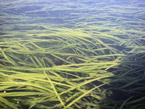 Wild celery is the dominant underwater grass in the lake and an important food for waterfowl. Photo: USGS |
The dominant submerged plant is wild celery, which likes salinity to be zero or very low, Campbell noted.
In the 1980s, Campbell said, the hinged cypress gates were replaced by unhinged stop log gates. Those were less effective at moving water out when the lake level was high from rain or pushed up by wind. Consequently, the lake was unusually high, making boating a lot easier. They were eventually replaced by metal gates with larger openings.
“They are hearkening back to that time,” he said about the sportsmen who prefer high water.
Campbell said there were big negatives to the gate design used in the 1980s and that the fishing group now favors. During storms, he said, water can’t move out fast enough, increasing the risk of flooding. And they cut off access to crabs and herring. The result, he said, was the herring run crashed and the blue crab population declined.
In 2010, the refuge put in side gates to promote access for saltwater species that come into the lake, but especially to improve access for herring. Ever since then the lake has been able to flush itself, he said. Crab population rebounded, but additional data is needed to determine the status of the eel and herring fisheries.
Campbell said the refuge has put together a group of scientists to conduct more study of fisheries and water quality issues.
John Stanton, U.S. Fish and Wildlife Service supervisory wildlife biologist, said that before the 1950s, the lake had a large population of carp that was the target of a commercial gill net fishery for about eight years. After the carp were removed, he said, biologists noticed that the submerged vegetation on the east side had been re-established. Less than five years later, the musk grass doubled to about 14,000 acres.
Wild celery was introduced in the late 1950s, Stanton said. Today it is well established, along with muskgrass, redhead grass and pond grass. On the east side, 76 percent of the submerged plants are healthy. On the west side there is only 13 percent coverage.
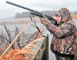 The hunting season on the lake keeps restaurants full in Hyde County. Photo: N.C. Sportsman |
“It’s markedly different,” Stanton said. “I was out there in 1994. It’s changed a lot. It was obvious to me that something has been going on in the last 20 years but noticeably so in the last decade.”
Starting in 1989, he said, the refuge began taking plant surveys every two to three years, but there was a big gap between 2004 and 2013 because of cuts in staffing. Stanton said that it’s not clear what has caused the decrease in underwater plants on the west side but it could be related to runoff from farm fields and bird impoundments.
All along, the management of the refuge, he said, has been hobbled by budget shortfalls. For instance, much is not known about drainage patterns and volume, but installation of testing equipment in the drainage canals would be very costly.
“We didn’t have those kinds of funds,” Stanton said. “We tried to do the bare minimum, to do what we had to do. You kind of work with what you’ve got.”
Stanton said the refuge has got some “rough, crude” information on water quality but needs quantitative information. The health of the submerged plants in the lake, he said, serves as a sort of canary-in-the-coal-mine as to the lake’s overall health.
“The bottom line is they’re adding nutrients,” he said. “We don’t really know what nutrients.”
Farmer Blythe Davis, a native of Hyde County who has been farming for 37 years, said that the water-quality problems in the lake are largely caused by people who pump their drainage directly into the lake – which he does not do.
Davis said that the issue with the water level in the lake comes up every few years, but proponents seem to be pushing harder now. But if the water level in the lake is raised, he said it could change the marsh and cause jurisdictional issues with the Army Corps of Engineers. As it is now, the lake is barely above sea level.
 Bill Rich |
In the past, Davis said, the high water probably led to algal blooms and depletion of herring and eel.
“They might not get a real good trade-off, he said. “I think that they should leave the gates just like they are.”
Michelle Moorman, a hydraulic technician with U.S. Geological Survey, said that the lake has elevated levels of chlorophyll and nitrogen from nutrients. “The question is why,” she said. “A lot of nutrients are in the sediment. So you still might have these issues. You can’t just cut off the source and expect the problem to go away overnight.”
Nutrient levels change throughout the year, she said, and are influenced by numerous factors, including the season, the water temperature and the layer of water it is measured from. Sources can include animal waste, fertilizers, septic system leaks and organic matter such as leaves and insects.
Hyde County Manager Bill Rich said that the county passed a resolution in September in support of the refuge’s effort to study restoration of the lake. But he said he believes that the recreational users are an important part of the cure.
Rich, a Hyde native who has enjoyed crabbing and boating on Mattamuskeet, said that the lake is the county’s most popular mainland tourist attraction and is an important revenue producer for the county, one of the poorest in the state. The lake is “perfectly situated,” he said, within miles of Fairfield, Engelhard and Swan Quarter, the county seat.
During the recent duck hunting season, Rich said, as many as 2,000 hunters came to the Mattamuskeet area, filling every motel room and every restaurant seat available.
“We’ve got to create a situation where the duck hunters are happy, where there’s fish for the fishermen, birds for the birdwatchers,” he said. “And that can be done.”


