Reprinted from the Island Free Press
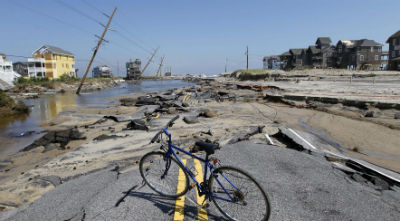 N.C. 12 near Rodanthe was a twisted mess after Irene. |
RODANTHE — Transportation planners most likely will replace the temporary bridge over the N.C.12 breach on Pea Island with a permanent one at the same location, but it will still be months before the long-term fix is chosen for the highway breach in nearby Rodanthe.
Massive sound flooding from Hurricane Irene in August tore a jagged inlet through the road six miles south of Oregon Inlet and destroyed a huge section of N.C. 12 between south at the S-curves and Mirlo Beach.
Supporter Spotlight
After numerous meetings with teams of agency representatives and coastal scientists, the state Department of Transportation “conceptually” chose the alternative at Pea Island that will stay within the existing state road easement, Beth Smyre, a DOT project planning engineer, said recently.
The agency is still responding to some comments from the Army Corps of Engineers and other agencies about the amount of analysis done at the site, Smyre said. She expects the alternative to be officially announced at the end of July.
The alternative in Rodanthe, however, won’t be decided until later this year, she said. “What we’re trying to do,” she said, “is move ahead with Pea Island first.”
The new bridge will be built adjacent to the temporary military bridge built after the storm. It will be longer and higher than originally proposed —- about 2 miles in length and 25 feet in the air — and will be designed similar to the replacement bridge planned over Oregon Inlet.
With a cost estimate of $100 million, DOT is in the process of incorporating the project proposal in the most recent Transportation Improvement Plan, Smyre said. The hope is to have a contract let by late December or early January.
Supporter Spotlight
As the second phase of the project to replace the Herbert C. Bonner Bridge over Oregon Inlet, the long-term solutions were pushed up in the plan because of the hurricane damage. Construction of a parallel bridge to replace Bonner Bridge, meanwhile, is expected to start by early January, Smyre said, depending on when the permits are issued.
Beach re-nourishment had originally been included in the proposed long-term alternatives at both breach locations, but was dropped by DOT in December because of the high cost, geological characteristics and lack of suitable sand sources. Other alternatives at Pea Island that had been proposed were construction of a bridge to the west of the breach or moving the road to the west.
With beach re-nourishment eliminated, two options remain for Rodanthe: an elevated bridge within the existing right of way or a 2.5-mile span that curves out into Pamlico Sound and ties in south of Mirlo Beach.
But in a DOT report published, coastal experts take a dim view of the elevated bridge. The panel of eight coastal scientists and engineers met in October with 23 representatives of DOT and other agencies to discuss the proposed alternatives.
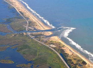 Irene blew a couple of new inlets into Pea Island. Photo: International Business Times |
“The panel agreed that a bridge within the existing N.C. 12 easement/right of way is not the best long-term solution at the Rodanthe breach site because of the panel’s concerns that the high shoreline erosion rate in this area could be challenging,” the report said. “The panel was concerned that the high erosion rate would ultimately result in the structure being in the ocean a notable distance from shore.”
But the panel agreed, the report continued, that a bridge built in the sound, west of the southern end of Pea Island National Wildlife Refuge and the northern end of Rodanthe “would be less vulnerable to potential future changes in Hatteras Island resulting from shoreline erosion and breach formation.”
The geology of the island between S-Curves and the Rodanthe pier makes the area one of the most vulnerable on the Outer Banks to future inlet formation, the panel said. If an inlet were created, either from storm-driven ocean waves or sound tide, it would tend to migrate south like Oregon Inlet.
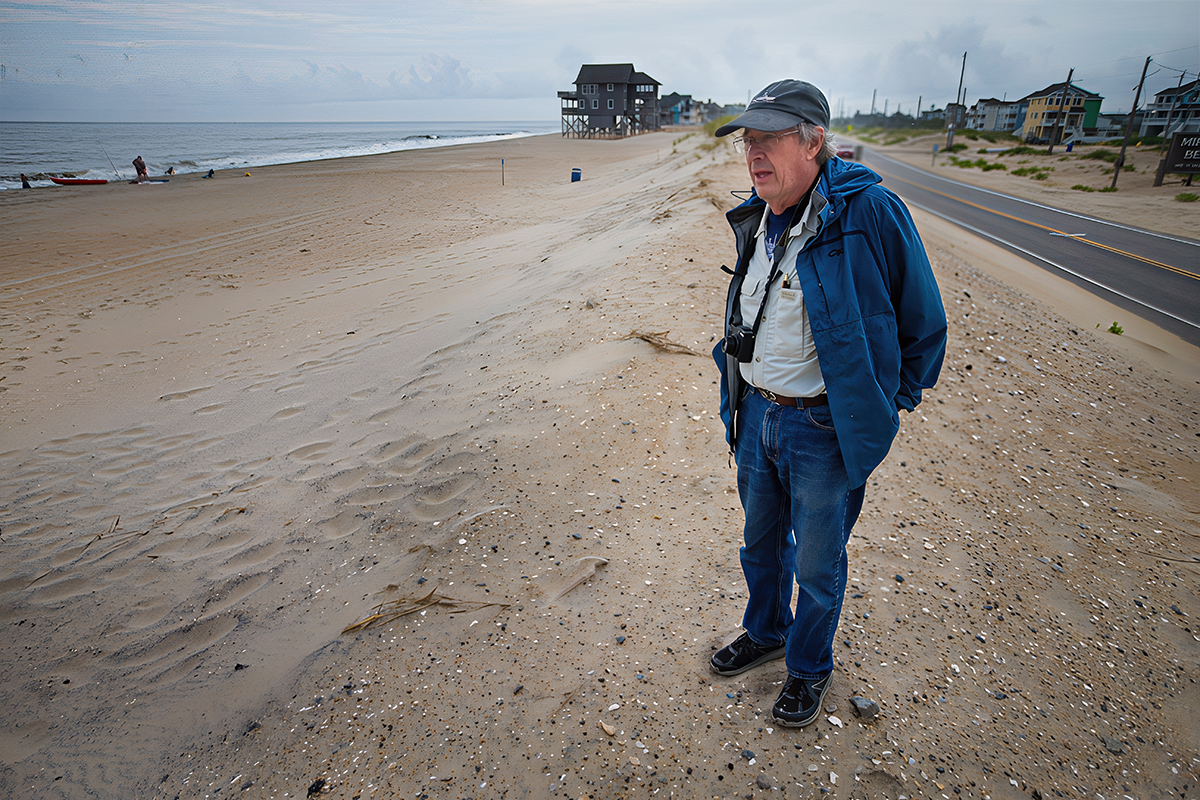
Property owners in Mirlo Beach, a subdivision on the north end of Rodanthe, have mixed feelings about the sound bridge, said Wes Hutchinson, vice-president of the Mirlo Beach Homeowners’ Association, depending on whether they have soundfront or oceanfront property. But still, no one is happy about the prospect of a bridge in the ocean, an inevitability of the right of way alternative.
“That bridge would be on the beach and in the surf rapidly,” he said. “That bridge I think would destroy Rodanthe.
“The 2.5-mile bridge that goes out into the sound — in some ways that may be better,” he said. “At least there will a beach there.”
Mirlo Beach was slammed by sound tide during Irene and suffered severe damage, partly because DOT’s sandbags along the ocean redirected the water.
The association and seven property owners who had damages ranging from $30,000 to $70,000 each — not including their interiors — have been considering taking legal action against DOT, said association president Jim Meyer.
But even if a lawyer agreed to do a lawsuit on a contingency basis, there would still be considerable cost, he said.
“It comes down to how much money do we want to continue to spend on this?” Meyer said. “I get the sense from some homeowners, ‘It’s done. Let’s move on.’”
Meyer said that the association spent about $180,000 to replace and repair damage to the road and other infrastructure, which was covered by homeowners’ fees and lot assessments. As a consequence, many feel tapped out.
“It’s probably not fair to put that burden on the homeowners’ association,” he said. “I hate to give up, but it’s like pouring money into a hole.”
Hutchinson said he understands why everyone in Mirlo feels exhausted, emotionally and financially. Yet, not taking action does not resolve anything.
“My concern is the next time there’s soundside flooding,” he said, “it’ll happen all over again.”
This story is provided courtesy of The Island Free Press, an online newspaper serving Hatteras and Ocracoke islands. Coastal Review Online is partnering with the Free Press to provide readers with more stories of coastal interest.


